Cof Cymru: National Historic Assets of Wales · Wales
Cowhouse at Uwchlawr-coed
Llanbedr, Gwynedd, Wales
A Grade II listed building in Llanbedr, Gwynedd, designated on 29 October 2003.
The record
- Designation
- Listed building, Grade II
- Broad class
- Agriculture and Subsistence
- Date of designation
- 29 October 2003
- Locality
- Llanbedr
- Community
- Llanbedr
- Unitary authority
- Gwynedd
- Country
- Wales
- Coordinates
- 52.81123, -4.07752
- Cadw reference
- 81996
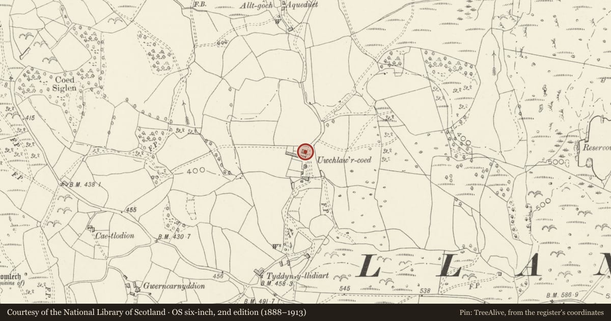
Slide toward Today to fade the historical sheet and see the modern map underneath.
David Rumsey Map Collection, Stanford LibrariesDavid Rumsey Map Collection, Stanford LibrariesDavid Rumsey Map Collection, Stanford LibrariesLlyfrgell Genedlaethol Cymru – The National Library of WalesDavid Rumsey Map Collection, Stanford Libraries
5 historical maps cover this location, the earliest the 1795 map "To Sir Watkin Williams-Wynn Bart ... the map of the six counties of North Wales is most humbly inscribed by his obedient humble servant" (Llyfrgell Genedlaethol Cymru – The National Library of Wales).
Historical maps covering this location
- 1795 · To Sir Watkin Williams-Wynn Bart ... the map of the six counties of North Wales is most… (Llyfrgell Genedlaethol Cymru – The National Library of Wales)
- 1883 · Watershed map England, Wales 3. (David Rumsey Map Collection, Stanford Libraries)
- 1896 · Sheet 7. Ordnance Survey of England and Wales. (David Rumsey Map Collection, Stanford Libraries)
- 1899 · 135 Harlech (Hills) (David Rumsey Map Collection, Stanford Libraries)
- 1901 · Sheet 9 and 10. (David Rumsey Map Collection, Stanford Libraries)
Cadw's description
Location
Located at the E side of a country road c2km SE of the village of Llanbedr. The cowhouse is to N of the house and parallel to the agricultural range to its S.
History
Appears to be of similar construction and contemporary design with the older part of the parallel agricultural range to N, probably C18.
Exterior
Cow house; roughly course boulder construction; roof of small old slates with stone copings. Built against the slope, and with a rear aisle, giving asymmetrical profile, and long catslide roof to rear. Entered from lower gable, with pitching door in upper gable, and small opening in aisle. Vent slits in long side walls.
Interior
The interior could not be inspected at the time of the survey.
Reason for designation
Included as a well preserved cowhouse which is a good example of regional type. Forms a group with the adjacent agricultural and domestic buildings, which together form an excellent and complete farmstead group.
Nearby in the register
- Agricultural range at Uwchlawr-coedAgriculture and Subsistenceunder 1 mi
- Pigsties at Uwchlawr-coedAgriculture and Subsistenceunder 1 mi
- Bakehouse at Uwchlawr-coedDomesticunder 1 mi
- Uwchlawr-coedDomesticunder 1 mi
Other entries of the same register within about three miles of this one, by straight line.