Cof Cymru: National Historic Assets of Wales · Wales
Cowhouse at Maes-y-garnedd
Llanbedr, Gwynedd, Wales
A Grade II listed building in Cwm Nantcol, Llanbedr, Gwynedd, designated on 29 October 2003.
The record
- Designation
- Listed building, Grade II
- Broad class
- Agriculture and Subsistence
- Date of designation
- 29 October 2003
- Locality
- Cwm Nantcol
- Community
- Llanbedr
- Unitary authority
- Gwynedd
- Country
- Wales
- Coordinates
- 52.82259, -4.01682
- Cadw reference
- 81995
Slide toward Today to fade the historical sheet and see the modern map underneath.
David Rumsey Map Collection, Stanford LibrariesDavid Rumsey Map Collection, Stanford LibrariesDavid Rumsey Map Collection, Stanford LibrariesLlyfrgell Genedlaethol Cymru – The National Library of WalesDavid Rumsey Map Collection, Stanford Libraries
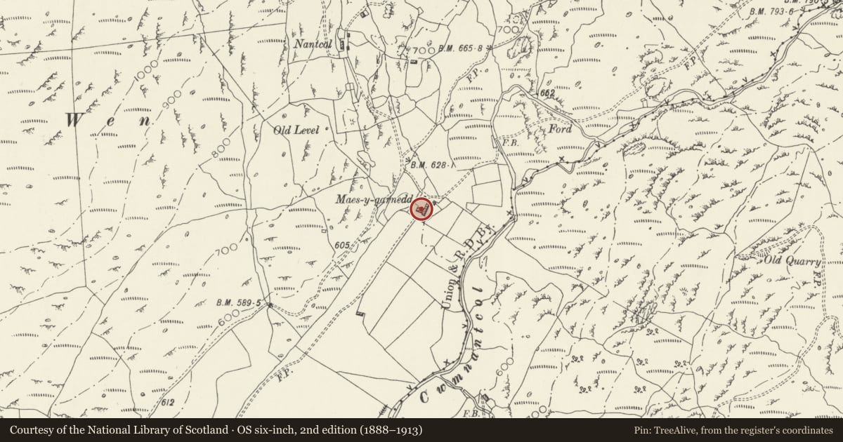
5 historical maps cover this location, the earliest the 1795 map "To Sir Watkin Williams-Wynn Bart ... the map of the six counties of North Wales is most humbly inscribed by his obedient humble servant" (Llyfrgell Genedlaethol Cymru – The National Library of Wales).
Historical maps covering this location
- 1795 · To Sir Watkin Williams-Wynn Bart ... the map of the six counties of North Wales is most… (Llyfrgell Genedlaethol Cymru – The National Library of Wales)
- 1883 · Watershed map England, Wales 3. (David Rumsey Map Collection, Stanford Libraries)
- 1896 · Sheet 7. Ordnance Survey of England and Wales. (David Rumsey Map Collection, Stanford Libraries)
- 1899 · 135 Harlech (Hills) (David Rumsey Map Collection, Stanford Libraries)
- 1901 · Sheet 9 and 10. (David Rumsey Map Collection, Stanford Libraries)
Cadw's description
Location
In an isolated rural location at the head of the Afon Cwmnantcol valley. Set at right angles to the SW corner of the house and attached agricultural range.
History
Probably C17 or C18 cowhouse, but was thought by the owner to pre-date the house at Maes-y-garnedd.
Exterior
Long agricultural building of drystone boulder construction with a plinth course at the entrance (NW) gable. Roof of small pegged slates, now heavily grouted, with stone gable copings. There is a doorway in the NW gable and a window offset to R (SE) end of the SW gable with ventilation slit to R.
Interior
The barn has an exposed roof of 4-bays and paired purlins, the truss closest to the entrance has ogee queen posts above the tie beam (the R hand blade now missing), the other 2 are pegged and collared trusses with tie beams.
Reason for designation
Listed as an excellent and well preserved early cowhouse which retains a good traditional character and forms a group with the farmhouse and other agricultural buildings at Maes-y-garnedd.
Nearby in the register
- Maes-y-garneddDomesticunder 1 mi
- Cartshed at Maes-y-garneddAgriculture and Subsistenceunder 1 mi
- Pigsty range at Maes-y-garneddAgriculture and Subsistenceunder 1 mi
- Field cowhouse at Maes-y-garneddAgriculture and Subsistenceunder 1 mi
Other entries of the same register within about three miles of this one, by straight line.