Cof Cymru: National Historic Assets of Wales · Wales
Brynffynnon
Llangedwyn, Powys, Wales
A Grade II listed building in Bryn Ffynnon, Llangedwyn, Powys, designated on 23 October 2003.
The record
- Designation
- Listed building, Grade II
- Broad class
- Domestic
- Date of designation
- 23 October 2003
- Locality
- Bryn Ffynnon
- Community
- Llangedwyn
- Unitary authority
- Powys
- Country
- Wales
- Coordinates
- 52.83020, -3.22033
- Cadw reference
- 81938
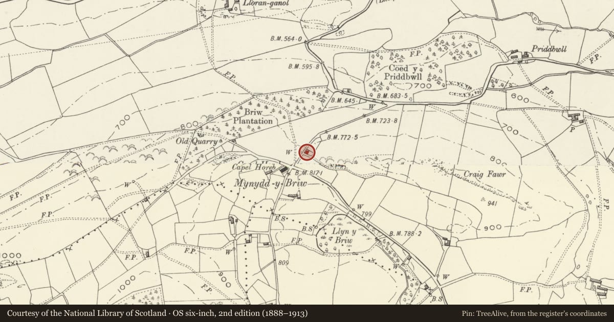
Slide toward Today to fade the historical sheet and see the modern map underneath.
David Rumsey Map Collection, Stanford LibrariesDavid Rumsey Map Collection, Stanford LibrariesDavid Rumsey Map Collection, Stanford LibrariesLlyfrgell Genedlaethol Cymru – The National Library of WalesDavid Rumsey Map Collection, Stanford Libraries
5 historical maps cover this location, the earliest the 1608 map "(13) Cambriae Typus." (David Rumsey Map Collection, Stanford Libraries).
Historical maps covering this location
- 1608 · (13) Cambriae Typus. (David Rumsey Map Collection, Stanford Libraries)
- 1795 · To Sir Watkin Williams-Wynn Bart ... the map of the six counties of North Wales is most… (Llyfrgell Genedlaethol Cymru – The National Library of Wales)
- 1883 · Watershed map England, Wales 3. (David Rumsey Map Collection, Stanford Libraries)
- 1897 · 137 Oswestry (Hills) (David Rumsey Map Collection, Stanford Libraries)
- 1901 · Sheet 9 and 10. (David Rumsey Map Collection, Stanford Libraries)
Cadw's description
Location
Beside a minor road 2½ km NNW of Llangedwyn Hall.
History
An encroachment cottage of the early C19. Brynffynnon was noted in 1841 amongst a large number of allotments of common of under 20 years duration, the house therefore built no earlier than 1821; a tenancy of John Davies under the Wynnstay estate. The cottage may have been blind-back prior to the addition of the C20 rear extension. The estate at this period appears to have generally tolerated encroachments or sponsored developments; perhaps a policy related to enclosure.
Exterior
A two bay, two storey cottage in local uncoursed masonry with a roof of small random slates and tile ridge. Large stone chimney at right, with a rendered heightening. Windows aligned vertically at left and right, now with timber casements. Lightly constructed later central porch. Small front enclosure with stone wall and timber gate.
Flat-roofed C20 rear and side extensions, the latter with a window overlooking the front enclosure.
Interior
Not inspected.
Reason for designation
A closely dated cottage of encroachment type, which has retained its historic character notwithstanding enlargement.
Nearby in the register
- Priddbwll-bach (old house)Domesticunder 1 mi
- Bron HeulogDomesticunder 1 mi
- Lloran UchaDomestic1 mi
- Priddbwll-mawrDomestic1 mi
Other entries of the same register within about three miles of this one, by straight line.