Cof Cymru: National Historic Assets of Wales · Wales
Pont Felin-newydd
Llansilin, Powys, Wales
A Grade II listed building in Felin-newydd, Llansilin, Powys, designated on 25 September 2003.
The record
- Designation
- Listed building, Grade II
- Broad class
- Transport
- Date of designation
- 25 September 2003
- Locality
- Felin-newydd
- Community
- Llansilin
- Unitary authority
- Powys
- Country
- Wales
- Coordinates
- 52.85603, -3.15521
- Cadw reference
- 81912
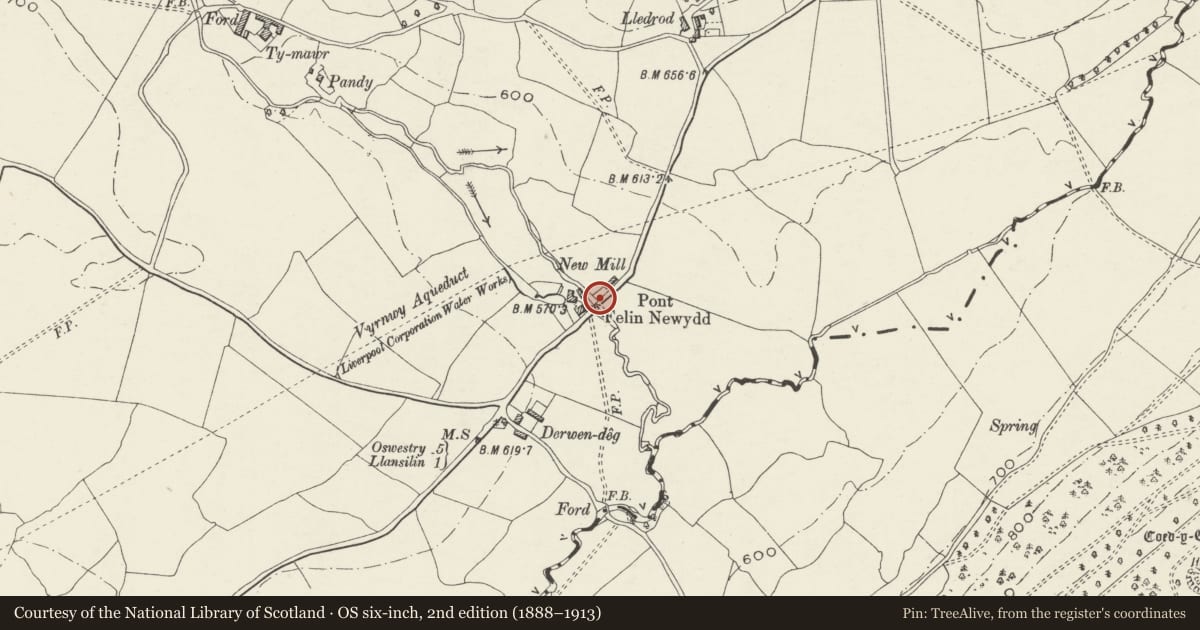
Slide toward Today to fade the historical sheet and see the modern map underneath.
David Rumsey Map Collection, Stanford LibrariesDavid Rumsey Map Collection, Stanford LibrariesDavid Rumsey Map Collection, Stanford LibrariesLlyfrgell Genedlaethol Cymru – The National Library of WalesDavid Rumsey Map Collection, Stanford Libraries
5 historical maps cover this location, the earliest the 1637 map "Particular description of Wales. Cambria seu Wallia" (David Rumsey Map Collection, Stanford Libraries).
Historical maps covering this location
- 1637 · Particular description of Wales. Cambria seu Wallia (David Rumsey Map Collection, Stanford Libraries)
- 1795 · To Sir Watkin Williams-Wynn Bart ... the map of the six counties of North Wales is most… (Llyfrgell Genedlaethol Cymru – The National Library of Wales)
- 1883 · Watershed map England, Wales 3. (David Rumsey Map Collection, Stanford Libraries)
- 1897 · 137 Oswestry (Hills) (David Rumsey Map Collection, Stanford Libraries)
- 1901 · Sheet 9 and 10. (David Rumsey Map Collection, Stanford Libraries)
Cadw's description
Location
Over the Afon Ogau about 2 km north-east of the village of Llansilin.
History
Possibly rebuilt in the C19, but preserving a dual stream arrangement established when the mill was set up. The parapet is of a common local type much found on County bridges.
Exterior
Pont felin-newydd has two arches for the Afon Ogau and a separate small arch for the tailrace of the Felin Newydd. The main arches are of about 3 m and 2 m span, and the arch for the tailrace about 1½ m span.
Local slatey stonework with segmental arches with a corbel course on the extrados and a cutwater. The parapet is in thin orthostat blocks, turning out at all four corners; however the upstream parapet is shorter, as it only covers the two main arches; the downstream arch is extended west to cover the tailrace of the mill emerging from a culvert.
Reason for designation
A bridge of good local late vernacular character, oddly adapted to span the tailrace of the mill as well and the river. Listed also for group value with Felin-newydd.
Nearby in the register
- Felin Newydd with Attached Former Miller's Cottage and ShedNo class recordedunder 1 mi
- Felin-newydd (house)No class recordedunder 1 mi
- Felin-newydd stablesDomesticunder 1 mi
- Lofted Cartshed Range at LledrodAgriculture and Subsistenceunder 1 mi
Other entries of the same register within about three miles of this one, by straight line.