Cof Cymru: National Historic Assets of Wales · Wales
Drinking Fountain in Llansilin village
Llansilin, Powys, Wales
A Grade II listed building in Llansilin village, Llansilin, Powys, designated on 25 September 2003.
The record
- Designation
- Listed building, Grade II
- Broad class
- Water Supply and Drainage
- Date of designation
- 25 September 2003
- Locality
- Llansilin village
- Community
- Llansilin
- Unitary authority
- Powys
- Country
- Wales
- Coordinates
- 52.84538, -3.17570
- Cadw reference
- 81898
Slide toward Today to fade the historical sheet and see the modern map underneath.
David Rumsey Map Collection, Stanford LibrariesDavid Rumsey Map Collection, Stanford LibrariesDavid Rumsey Map Collection, Stanford LibrariesLlyfrgell Genedlaethol Cymru – The National Library of WalesDavid Rumsey Map Collection, Stanford Libraries
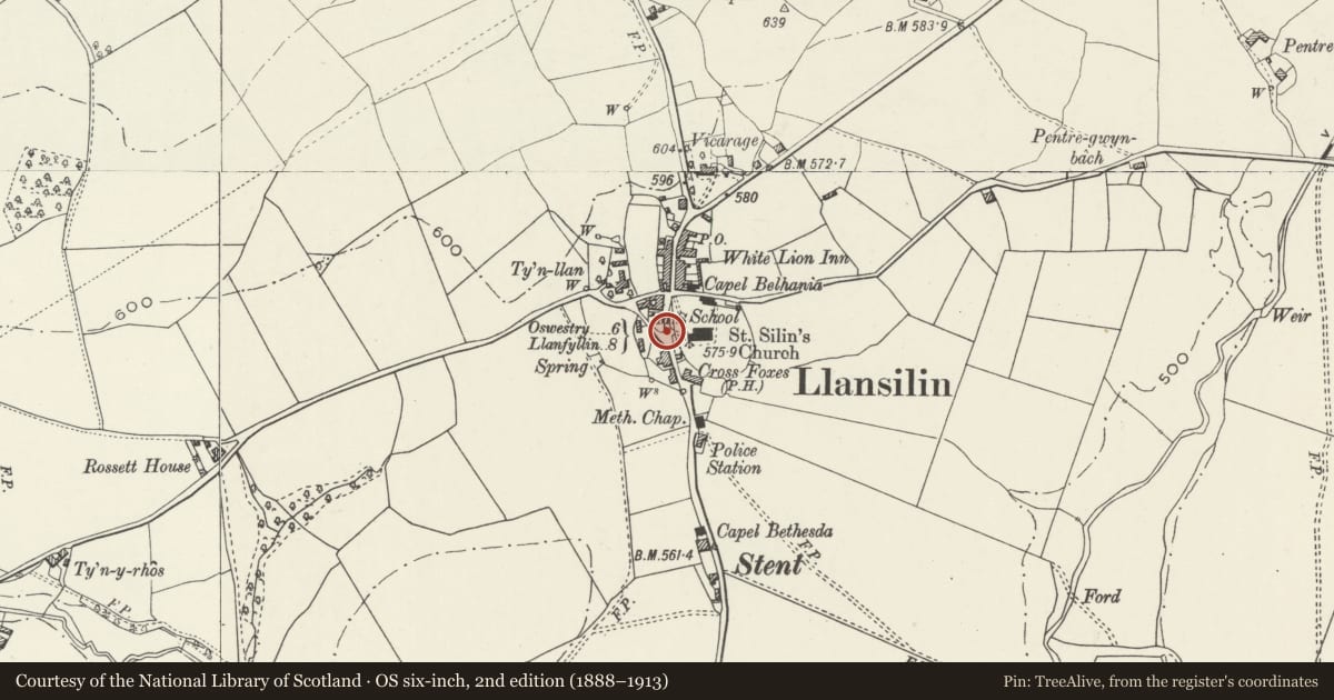
5 historical maps cover this location, the earliest the 1637 map "Particular description of Wales. Cambria seu Wallia" (David Rumsey Map Collection, Stanford Libraries).
Historical maps covering this location
- 1637 · Particular description of Wales. Cambria seu Wallia (David Rumsey Map Collection, Stanford Libraries)
- 1795 · To Sir Watkin Williams-Wynn Bart ... the map of the six counties of North Wales is most… (Llyfrgell Genedlaethol Cymru – The National Library of Wales)
- 1883 · Watershed map England, Wales 3. (David Rumsey Map Collection, Stanford Libraries)
- 1897 · 137 Oswestry (Hills) (David Rumsey Map Collection, Stanford Libraries)
- 1901 · Sheet 9 and 10. (David Rumsey Map Collection, Stanford Libraries)
Cadw's description
Location
At a fork in the road at the west side of High Street in Llansilin village, opposite the church.
History
A fountain erected in 1882 in memory of Walter Jones, surgeon, who was the son of the Rev. Walter Jones. It was fed from the Ffynnon Silin. Recently restored by local enthusiasts.
Exterior
A drinking fountain and horse trough in brown sandstone in the form of a square pillar, about 2 m high, with a rounded and decorated pediment on each face and a ball finial on a large base. Recess at front with damaged bronze tap. Two-step plinth with small round water basin. Kerb and cobbled surround.
Reason for designation
A good item of Victorian street furniture recalling the important campaign to bring clean water to village locations.
Nearby in the register
- The Malt House, including nos 1 and 2 Malthouse CottagesDomesticunder 1 mi
- Church of St SilinReligious, Ritual and Funeraryunder 1 mi
- MonfaDomesticunder 1 mi
- No. 1 Greenfield TerraceDomesticunder 1 mi
Other entries of the same register within about three miles of this one, by straight line.