Cof Cymru: National Historic Assets of Wales · Wales
Garden walls to S, W and N of Nantygarth
Graig, Newport, Wales
A Grade II listed building in Lower Machen, Newport, Graig, designated on 22 August 2003.
The record
- Designation
- Listed building, Grade II
- Broad class
- No class recorded
- Date of designation
- 22 August 2003
- Locality
- Lower Machen
- Town
- Newport
- Community
- Graig
- Unitary authority
- Newport
- Country
- Wales
- Coordinates
- 51.58558, -3.11827
- Cadw reference
- 81796
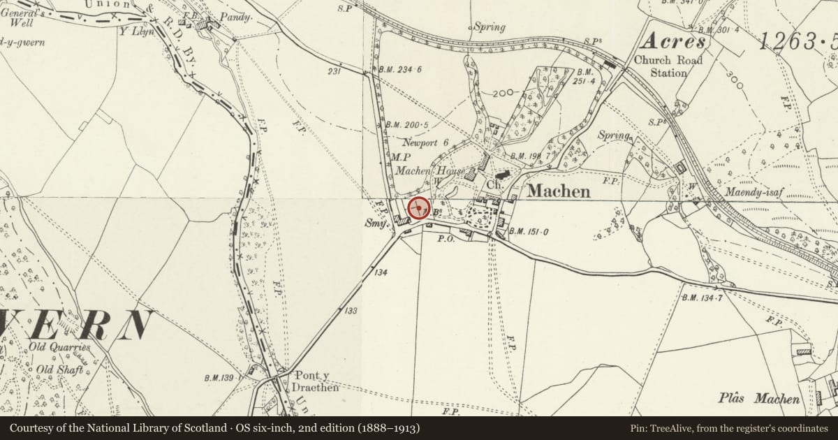
Slide toward Today to fade the historical sheet and see the modern map underneath.
David Rumsey Map Collection, Stanford LibrariesDavid Rumsey Map Collection, Stanford LibrariesDavid Rumsey Map Collection, Stanford LibrariesDavid Rumsey Map Collection, Stanford LibrariesDavid Rumsey Map Collection, Stanford Libraries
5 historical maps cover this location, the earliest the 1636 map "Cornubia : Devonia, Somersetus, Dorcestria, Wiltonia, Glocestria ..." (David Rumsey Map Collection, Stanford Libraries).
Historical maps covering this location
- 1636 · Cornubia : Devonia, Somersetus, Dorcestria, Wiltonia, Glocestria ... (David Rumsey Map Collection, Stanford Libraries)
- 1865 · England and Wales. England No. 6. (David Rumsey Map Collection, Stanford Libraries)
- 1895 · Sheet 11. Ordnance Survey of England and Wales. (David Rumsey Map Collection, Stanford Libraries)
- 1906 · 249 Newport (Hills) (David Rumsey Map Collection, Stanford Libraries)
- 1913 · Sheet 102. Newport. (David Rumsey Map Collection, Stanford Libraries)
Cadw's description
Location
On the W side of Lower Machen and on the N side of the main road through the village.
History
Picturesque Gothic garden wall to former outer garden of Machen House, now surrounding C20 house, Nantygarth. Wall is similar to that on W side of existing Machen House gardens. The walls are part of the Gothic setting of Machen House built 1831 for the Rev. C.A.S. Morgan.
Exterior
Walls of purple rubble stone with end-on coping stones, S wall runs W from driveway with pointed arched doorway in grey stone to left of driveway. At left end, SW corner tower of two walls with pointed opening to each outlined in squared grey stone and battlements. Wall then runs N with sequence from SW of corner tower, square pier, raised section of wall, square pier, another raised wall, pier and NW corner tower. The raised sections of wall have a pointed loop and 3 battlements alternately gabled and square, the piers are square with chamfered caps and small sandstone obelisk finials. The top corner tower is cruder than SW feature, with one blocked pointed opening. Plain garden wall runs back along N side to join garden wall of Machen House at another tower feature, this one with one E face into Machen House garden and one S into Nantygarth garden.
Reason for designation
Included as part of the group of Gothic estate buildings associated with Machen House.
Nearby in the register
- Volland House, The Forge, No 3 and Volland CottageNo class recordedunder 1 mi
- The Toll HouseNo class recordedunder 1 mi
- Footbridge over lake at Machen HouseTransportunder 1 mi
- Gatepiers, gate and garden walls to Machen HouseNo class recordedunder 1 mi
Other entries of the same register within about three miles of this one, by straight line.