Cof Cymru: National Historic Assets of Wales · Wales
Rhos-isaf Cottages
Llanrhaeadr-ym-Mochnant, Powys, Wales
A Grade II listed building in Ketley Bank, Llanrhaeadr-ym-Mochnant, Powys, designated on 14 August 2003.
The record
- Designation
- Listed building, Grade II
- Broad class
- Domestic
- Date of designation
- 14 August 2003
- Locality
- Ketley Bank
- Community
- Llanrhaeadr-ym-Mochnant
- Unitary authority
- Powys
- Country
- Wales
- Coordinates
- 52.80621, -3.29289
- Cadw reference
- 81786
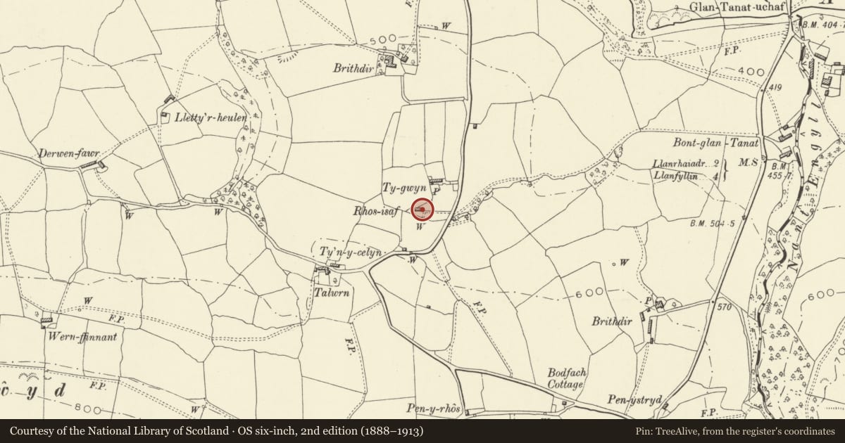
Slide toward Today to fade the historical sheet and see the modern map underneath.
David Rumsey Map Collection, Stanford LibrariesDavid Rumsey Map Collection, Stanford LibrariesDavid Rumsey Map Collection, Stanford LibrariesLlyfrgell Genedlaethol Cymru – The National Library of WalesDavid Rumsey Map Collection, Stanford Libraries
5 historical maps cover this location, the earliest the 1795 map "To Sir Watkin Williams-Wynn Bart ... the map of the six counties of North Wales is most humbly inscribed by his obedient humble servant" (Llyfrgell Genedlaethol Cymru – The National Library of Wales).
Historical maps covering this location
- 1795 · To Sir Watkin Williams-Wynn Bart ... the map of the six counties of North Wales is most… (Llyfrgell Genedlaethol Cymru – The National Library of Wales)
- 1883 · Watershed map England, Wales 3. (David Rumsey Map Collection, Stanford Libraries)
- 1897 · 137 Oswestry (Hills) (David Rumsey Map Collection, Stanford Libraries)
- 1901 · Sheet 9 and 10. (David Rumsey Map Collection, Stanford Libraries)
- 1916 · Sheet 60. Shrewsbury. (David Rumsey Map Collection, Stanford Libraries)
Cadw's description
Location
About 2 km south of Llanrhaeadr-ym-Mochnant, to the west of a minor road from Ketley Bank to Aber Rhaeadr.
History
C19 agricultural workers' cottages. One doorway (to the original cottage adjacent to the wash-house) has been blocked up, suggesting this and the adjacent cottage to its right were merged.
Exterior
A terrace of cottages originally three in number, apparently reduced to two (now unoccupied) facing south to a small enclosed forecourt, with a shared wash-house at left (west). Local slatey quasi-rubble masonry, the walls of the cottages painted white, the walls of the wash-house unpainted. Slate roof with tile ridge. Stone chimney at left shared between the wash-house and the left cottage, stone end-chimney at right. Informal rear extensions.
The range, including the wash-house, comprises four upper windows slightly unequally spaced and three doors and two windows, with the three lower domestic windows aligned with windows above. The two cottages originally at left and centre appear to share one of the upper windows. Apart from this, each cottage has a (modern) door and two four-pane casement windows with iron opening lights. The wash-house has a timber door and a slatted window (but no loft openings).
Interior
Interior not seen.
Reason for designation
An unusual unspoilt survival of a row of workers' cottages with wash-house, which has retained its character.
Nearby in the register
- Bontglantanat Farmhouse and BarnAgriculture and Subsistenceunder 1 mi
- Detached Agricultural Range to the south of Bontglantanat FarmhouseAgriculture and Subsistenceunder 1 mi
- Ty-Newydd DykeLinear Earthworkunder 1 mi
- Pont Glantanat Uchaf (partly in the communities of Llanrhaeadr-ym-Mochnant (S) and Llangedwyn)Transportunder 1 mi
Other entries of the same register within about three miles of this one, by straight line.