Cof Cymru: National Historic Assets of Wales · Wales
8 Severn Square
Newtown and Llanllwchaiarn, Powys, Wales
A Grade II listed building in Newtown, Newtown and Llanllwchaiarn, Powys, designated on 9 May 1988.
The record
- Designation
- Listed building, Grade II
- Broad class
- Domestic
- Date of designation
- 9 May 1988
- Locality
- Newtown
- Community
- Newtown and Llanllwchaiarn
- Unitary authority
- Powys
- Country
- Wales
- Coordinates
- 52.51588, -3.31381
- Cadw reference
- 8170
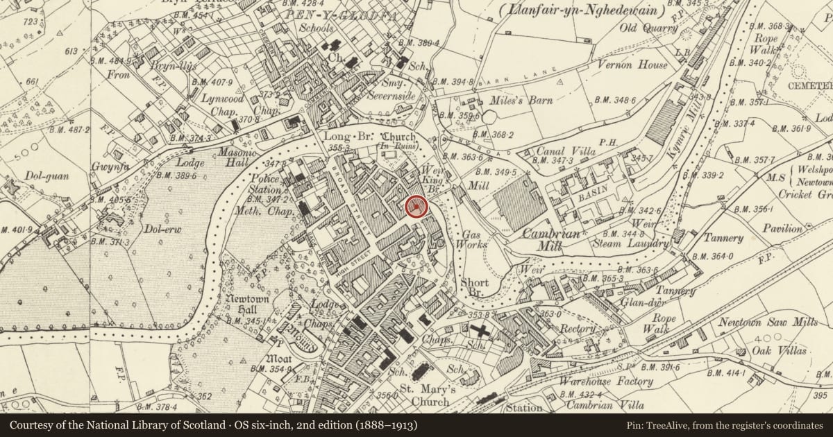
Slide toward Today to fade the historical sheet and see the modern map underneath.
David Rumsey Map Collection, Stanford LibrariesDavid Rumsey Map Collection, Stanford LibrariesDavid Rumsey Map Collection, Stanford LibrariesDavid Rumsey Map Collection, Stanford LibrariesLlyfrgell Genedlaethol Cymru – The National Library of Wales
5 historical maps cover this location, the earliest the 1637 map "Particular description of Wales. Cambria seu Wallia" (David Rumsey Map Collection, Stanford Libraries).
Historical maps covering this location
- 1637 · Particular description of Wales. Cambria seu Wallia (David Rumsey Map Collection, Stanford Libraries)
- 1795 · To Sir Watkin Williams-Wynn Bart ... the map of the six counties of North Wales is most… (Llyfrgell Genedlaethol Cymru – The National Library of Wales)
- 1883 · Watershed map England, Wales 3. (David Rumsey Map Collection, Stanford Libraries)
- 1899 · 165 Montgomery (Hills) (David Rumsey Map Collection, Stanford Libraries)
- 1901 · Sheet 14. (David Rumsey Map Collection, Stanford Libraries)
Cadw's description
Location
Set back from the street line. Stepped up from No 7 adjoining and facing Gas Street.
History
Later C17 heavily altered C19.
Exterior
2 storey and attic with gable end advanced to street. Flemish bond brick. Steeply pitched slate roof, pitch daubed. Shouldered raking gable parapets survive to rear elevation. Oversailing eaves. Truncated, panelled, lateral chimney with gablet to right. Bands at floor levels with further bands across gable ends.
Small paned cross window to attic, iron lights. Cambered header arch, shallow reveals, no sill. Offset 3 light small paned iron transomed window to 1st floor, soldier arch. Blocked earlier window with gauged brick voussoirs to right. Small paned iron cross window to ground floor right. Cambered brick voussoirs, shallow reveals, no sill.
Doorcase offset to left, modern door.
Cambered arches to blocked/dummy windows on right end elevation. C19 3 light iron casement to ground floor. Modern windows to angle adjoining No 7 and rear elevations.
Interior
Interior has re-located oak stair, plain newel posts, turned balusters, flat rail. Stop chamfered beams. Corner fire places and roll moulded plaster cornices to rear rooms on 1st and ground floors. Cambered brick mantel arch to lateral fireplace on ground floor.
Reason for designation
Group value.
Nearby in the register
- 7 Severn SquareDomesticunder 1 mi
- 6 Severn SquareDomesticunder 1 mi
- 5 Severn SquareDomesticunder 1 mi
- Studio 8Domesticunder 1 mi
Other entries of the same register within about three miles of this one, by straight line.