Cof Cymru: National Historic Assets of Wales · Wales
BJ's Electrical
Newtown and Llanllwchaiarn, Powys, Wales
A Grade II listed building in Newtown and Llanllwchaiarn, Powys, designated on 9 May 1988.
The record
- Designation
- Listed building, Grade II
- Broad class
- Commercial
- Date of designation
- 9 May 1988
- Community
- Newtown and Llanllwchaiarn
- Unitary authority
- Powys
- Country
- Wales
- Coordinates
- 52.51455, -3.31488
- Cadw reference
- 8140
Slide toward Today to fade the historical sheet and see the modern map underneath.
David Rumsey Map Collection, Stanford LibrariesDavid Rumsey Map Collection, Stanford LibrariesDavid Rumsey Map Collection, Stanford LibrariesDavid Rumsey Map Collection, Stanford LibrariesLlyfrgell Genedlaethol Cymru – The National Library of Wales
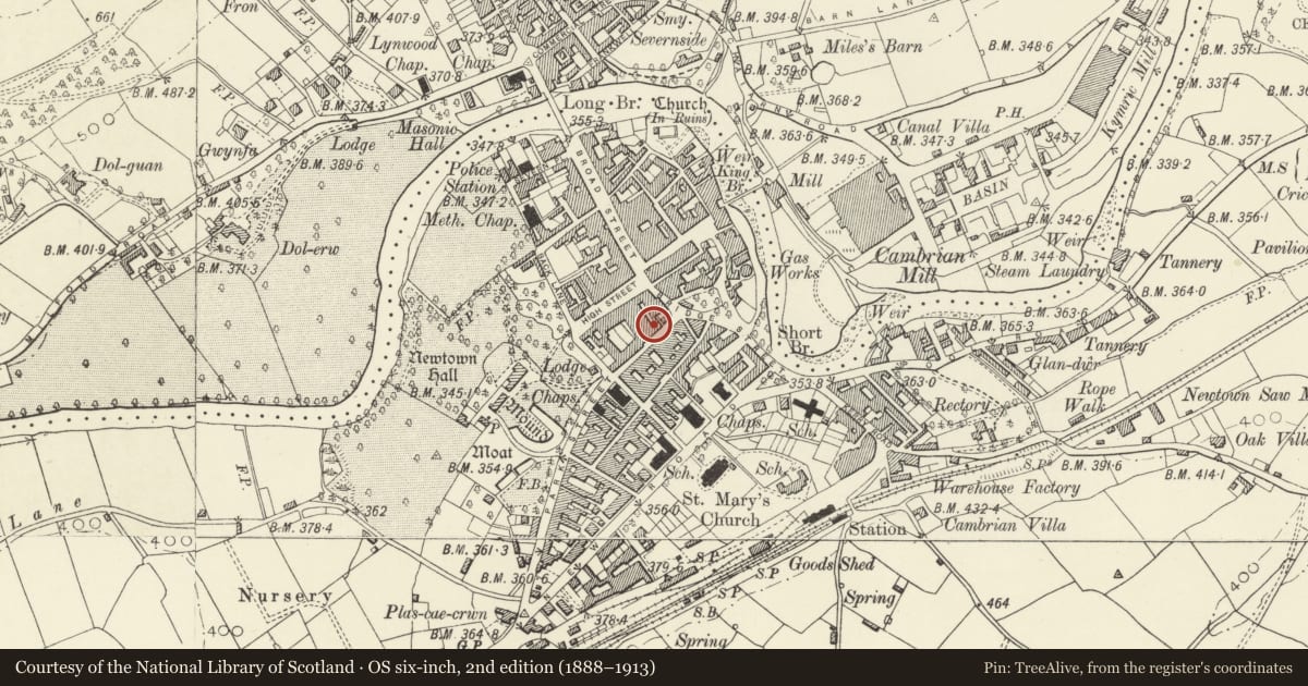
5 historical maps cover this location, the earliest the 1637 map "Particular description of Wales. Cambria seu Wallia" (David Rumsey Map Collection, Stanford Libraries).
Historical maps covering this location
- 1637 · Particular description of Wales. Cambria seu Wallia (David Rumsey Map Collection, Stanford Libraries)
- 1795 · To Sir Watkin Williams-Wynn Bart ... the map of the six counties of North Wales is most… (Llyfrgell Genedlaethol Cymru – The National Library of Wales)
- 1883 · Watershed map England, Wales 3. (David Rumsey Map Collection, Stanford Libraries)
- 1899 · 165 Montgomery (Hills) (David Rumsey Map Collection, Stanford Libraries)
- 1901 · Sheet 14. (David Rumsey Map Collection, Stanford Libraries)
Cadw's description
Location
On the street line adjoining the Market Street.
History
c1870 3 storey former Public House (The Angel Vaults).
Exterior
Flemish bond brick with freestone dressings and plinth; plastered to ground floor. Low half-hipped slate roof, corniced verges. Pierced trefoil parapet, gabled finials to ends over truncated half colonettes with capitals. Pointed arches to three, 2nd floor windows. Hoods, impost band, peirced quatrefoils to tympanii. Nookshafts, rusticated quoins, sillband. Victorian sashes. Tirpartite windows with similar detail but cambered arches to 1st floor left, single light similar to right; no quatrefoils. Tripartite bar-room window to ground floor left. Cambered hoods and heads. Plate glass. Caernarfon arches to former doorway to right and canted corner to left below moulded corbel. Carriageway to extreme right. Keystoned cambered arch, rusticated plaster voussoirs.
Former Angel Brewery to rear.
Reason for designation
Group value.
Nearby in the register
- House to rear of No. 31 Market StreetDomesticunder 1 mi
- 31 Market StreetCommercialunder 1 mi
- Market HallCommercialunder 1 mi
- Caroline'sCommercialunder 1 mi
Other entries of the same register within about three miles of this one, by straight line.