Cof Cymru: National Historic Assets of Wales · Wales
Market Hall
Newtown and Llanllwchaiarn, Powys, Wales
A Grade II listed building in Newtown and Llanllwchaiarn, Powys, designated on 9 May 1988.
The record
- Designation
- Listed building, Grade II
- Broad class
- Commercial
- Date of designation
- 9 May 1988
- Community
- Newtown and Llanllwchaiarn
- Unitary authority
- Powys
- Country
- Wales
- Coordinates
- 52.51457, -3.31511
- Cadw reference
- 8139
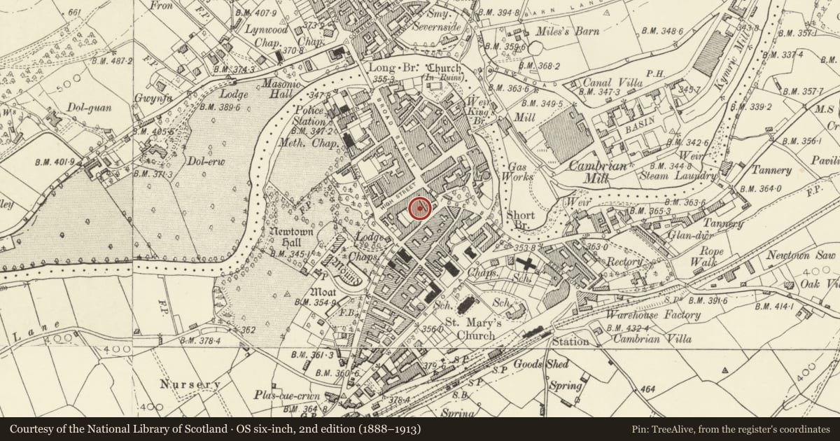
Slide toward Today to fade the historical sheet and see the modern map underneath.
David Rumsey Map Collection, Stanford LibrariesDavid Rumsey Map Collection, Stanford LibrariesDavid Rumsey Map Collection, Stanford LibrariesDavid Rumsey Map Collection, Stanford LibrariesLlyfrgell Genedlaethol Cymru – The National Library of Wales
5 historical maps cover this location, the earliest the 1637 map "Particular description of Wales. Cambria seu Wallia" (David Rumsey Map Collection, Stanford Libraries).
Historical maps covering this location
- 1637 · Particular description of Wales. Cambria seu Wallia (David Rumsey Map Collection, Stanford Libraries)
- 1795 · To Sir Watkin Williams-Wynn Bart ... the map of the six counties of North Wales is most… (Llyfrgell Genedlaethol Cymru – The National Library of Wales)
- 1883 · Watershed map England, Wales 3. (David Rumsey Map Collection, Stanford Libraries)
- 1899 · 165 Montgomery (Hills) (David Rumsey Map Collection, Stanford Libraries)
- 1901 · Sheet 14. (David Rumsey Map Collection, Stanford Libraries)
Cadw's description
Location
On the street line opposite the entry to the Ladywell Shopping Centre.
History
1870 by David Walker of Liverpool for Wastel Brisco of Newtown Hall. The principal elevation formerly facing the High Street has been demolished. Said to have iron roofs by T Penson.
Exterior
7 bay brick front of English bond stock brick with stone bands at window level and to stepped plinth. Transverse double pile roof behind red brick parapet. Moulded brick eaves cornice with machiolated effect. Hipped slate roof and Victorian sash window to 1st floor of later bay on extreme left. Main facade symmetric with 2 doorways each flanked by 2 windows. Round arches, linked pointed hoodmoulds. Later glazing to windows. Doorways taller; sliding double doors. Rectangular iron cames to large upper "panels", small panels below. Fanlights. Doorway with blind fanlight to bay at extreme left.
Interior
Canted arcade of iron columns, decorative spandrels. Partition inserted during 1940's.
Reason for designation
Group value.
Nearby in the register
- BJ's ElectricalCommercialunder 1 mi
- House to rear of No. 31 Market StreetDomesticunder 1 mi
- 31 Market StreetCommercialunder 1 mi
- The Angel PHCommercialunder 1 mi
Other entries of the same register within about three miles of this one, by straight line.