Cof Cymru: National Historic Assets of Wales · Wales
Barn at Great House Farm
Llan-Maes, Vale of Glamorgan, Wales
A Grade II listed building in Llanmaes, Barry, Vale of Glamorgan, designated on 21 July 2003.
The record
- Designation
- Listed building, Grade II
- Broad class
- Agriculture and Subsistence
- Date of designation
- 21 July 2003
- Locality
- Llanmaes
- Town
- Barry
- Community
- Llan-Maes
- Unitary authority
- Vale of Glamorgan
- Country
- Wales
- Coordinates
- 51.41434, -3.46598
- Cadw reference
- 81299
Slide toward Today to fade the historical sheet and see the modern map underneath.
David Rumsey Map Collection, Stanford LibrariesDavid Rumsey Map Collection, Stanford LibrariesDavid Rumsey Map Collection, Stanford LibrariesDavid Rumsey Map Collection, Stanford LibrariesDavid Rumsey Map Collection, Stanford Libraries
5 historical maps cover this location, the earliest the 1636 map "Cornubia : Devonia, Somersetus, Dorcestria, Wiltonia, Glocestria ..." (David Rumsey Map Collection, Stanford Libraries).
Historical maps covering this location
- 1636 · Cornubia : Devonia, Somersetus, Dorcestria, Wiltonia, Glocestria ... (David Rumsey Map Collection, Stanford Libraries)
- 1637 · The fourth table of England. Cornub. Devonia, Somerset etc. (David Rumsey Map Collection, Stanford Libraries)
- 1865 · England and Wales. England No. 6. (David Rumsey Map Collection, Stanford Libraries)
- 1897 · 262 Pontypridd (Hills) (David Rumsey Map Collection, Stanford Libraries)
- 1897 · 262 Pontypridd (Outline) (David Rumsey Map Collection, Stanford Libraries)
Cadw's description
Location
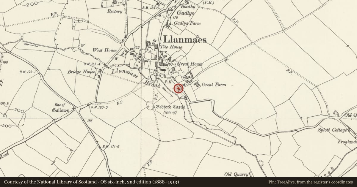
At the south entry to the village of Llanmaes and about 150m south of the Church of St. Cattwg.
History
C17 barn, altered probably in the C19.
Exterior
Built of local white limestone with a steel sheeting roof. The wall to the road has a central elliptical arch to the threshing floor with a plank door, the head would appear to be a C19 rebuilding with an increased width of door. To the left is a slit vent, to the right a taking-in door to the hayloft. Gables with slit vents, otherwise plain walling. Verges to roof indicate original thatching. Rear wall has a central blocked door with a much smaller head than on the road side, slit vent to right.
Interior
Interior not seen at resurvey, but is described in RCAHMW as having four bays. Roof type not known, but probably queen strut.
Reason for designation
Included as a C17 barn which, despite re-roofing, has retained its character.
Nearby in the register
- Llanmaes Castle (Malefant Castle)Manorunder 1 mi
- Dovecote at Llanmaes HouseAgriculture and Subsistenceunder 1 mi
- Llanmaes HouseDomesticunder 1 mi
- Walls, Gatepiers and Gates of Llanmaes HouseDomesticunder 1 mi
Other entries of the same register within about three miles of this one, by straight line.