Cof Cymru: National Historic Assets of Wales · Wales
Walls, Gatepiers and Gates of Llanmaes House
Llan-Maes, Vale of Glamorgan, Wales
A Grade II* listed building in Llanmaes, Barry, Vale of Glamorgan, designated on 21 July 2003.
The record
- Designation
- Listed building, Grade II*
- Broad class
- Domestic
- Date of designation
- 21 July 2003
- Locality
- Llanmaes
- Town
- Barry
- Community
- Llan-Maes
- Unitary authority
- Vale of Glamorgan
- Country
- Wales
- Coordinates
- 51.41516, -3.46662
- Cadw reference
- 81305
Slide toward Today to fade the historical sheet and see the modern map underneath.
David Rumsey Map Collection, Stanford LibrariesDavid Rumsey Map Collection, Stanford LibrariesDavid Rumsey Map Collection, Stanford LibrariesDavid Rumsey Map Collection, Stanford LibrariesDavid Rumsey Map Collection, Stanford Libraries
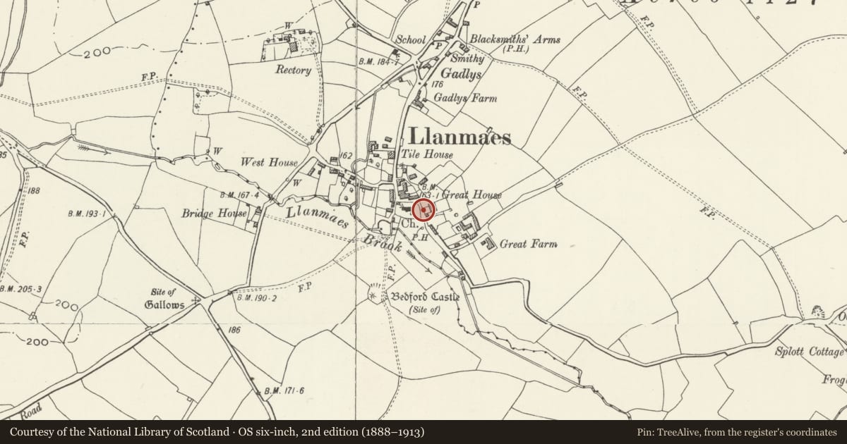
5 historical maps cover this location, the earliest the 1636 map "Cornubia : Devonia, Somersetus, Dorcestria, Wiltonia, Glocestria ..." (David Rumsey Map Collection, Stanford Libraries).
Historical maps covering this location
- 1636 · Cornubia : Devonia, Somersetus, Dorcestria, Wiltonia, Glocestria ... (David Rumsey Map Collection, Stanford Libraries)
- 1637 · The fourth table of England. Cornub. Devonia, Somerset etc. (David Rumsey Map Collection, Stanford Libraries)
- 1865 · England and Wales. England No. 6. (David Rumsey Map Collection, Stanford Libraries)
- 1897 · 262 Pontypridd (Hills) (David Rumsey Map Collection, Stanford Libraries)
- 1897 · 262 Pontypridd (Outline) (David Rumsey Map Collection, Stanford Libraries)
Cadw's description
Location
Surrounding the front and rear gardens of Llanmaes House.
History
Probably early C18 in origin but with several later alterations and repairs. The tack-room attached to the south-west corner is not shown on the Tithe map of 1843 but was probably added fairly soon afterwards.
Exterior
Built of local limestone rubble with ashlar piers and steps. A pair of square gatepiers with base and cornice stand opposite the front door above two steps. They hold wrought iron gates which are not original, and carry very large incised vases. On either side of the gateway a wall about 2m in height with a flat stone coping and ramped ends. To the left it joins the higher wall with a pointed arch doorway which surrounds the service court and then goes to a plain later opening. To the right it joins a service building with hipped slate roof and large stack on the corner of the property. The south wall has piers and panels of iron railings making a clairvoyee. The wall continues past the dovecote (qv) and along the east side of the garden where it also has panels of later railings, square piers with pyramid caps and later iron gates. The north wall is plain rubble.
Reason for designation
Included and highly graded as an integral part of the design of the architecturally important Llanmaes House.
Nearby in the register
- Railed Tomb to Nicholl family to east of Chancel of Church of St CattwgReligious, Ritual and Funeraryunder 1 mi
- Llanmaes HouseDomesticunder 1 mi
- Church of St CattwgReligious, Ritual and Funeraryunder 1 mi
- Cross in Churchyard of Church of St CattwgReligious, Ritual and Funeraryunder 1 mi
Other entries of the same register within about three miles of this one, by straight line.