Cof Cymru: National Historic Assets of Wales · Wales
Plas Cottage
Pencarreg, Carmarthenshire, Wales
A Grade II listed building in Pencarreg, Carmarthenshire, designated on 23 June 2003.
The record
- Designation
- Listed building, Grade II
- Broad class
- Domestic
- Date of designation
- 23 June 2003
- Locality
- Pencarreg
- Community
- Pencarreg
- Unitary authority
- Carmarthenshire
- Country
- Wales
- Coordinates
- 52.08746, -4.13657
- Cadw reference
- 81234
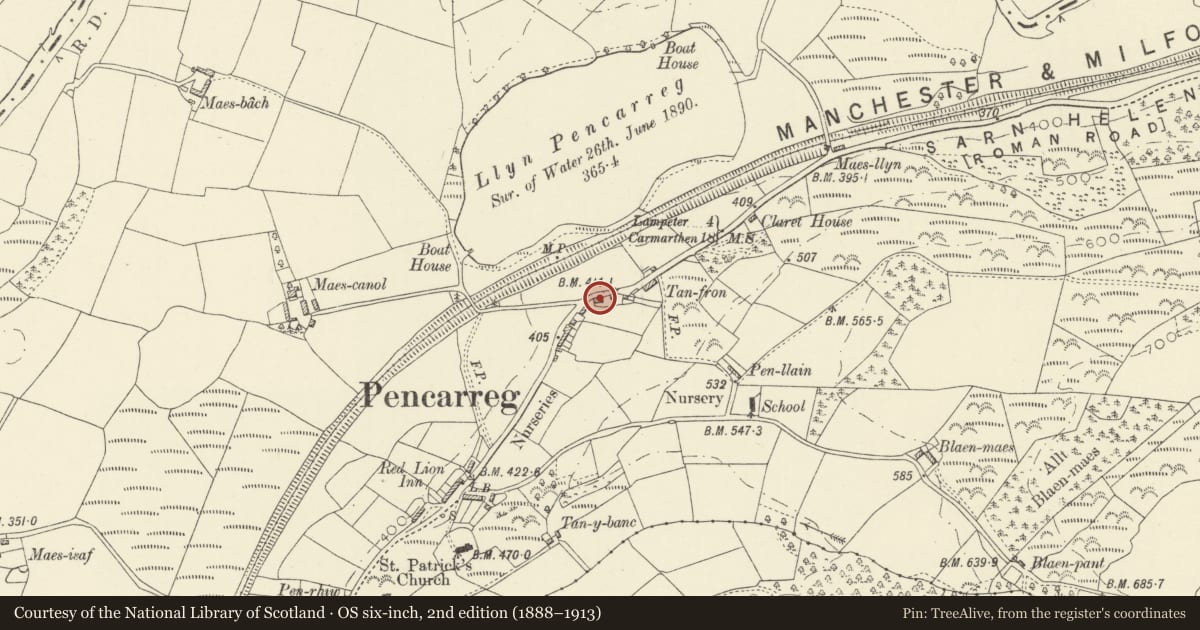
Slide toward Today to fade the historical sheet and see the modern map underneath.
David Rumsey Map Collection, Stanford LibrariesDavid Rumsey Map Collection, Stanford LibrariesDavid Rumsey Map Collection, Stanford LibrariesDavid Rumsey Map Collection, Stanford LibrariesDavid Rumsey Map Collection, Stanford Libraries
5 historical maps cover this location, the earliest the 1608 map "(13) Cambriae Typus." (David Rumsey Map Collection, Stanford Libraries).
Historical maps covering this location
- 1608 · (13) Cambriae Typus. (David Rumsey Map Collection, Stanford Libraries)
- 1830 · V.3:11-15:XV. Britisches Reich. A. Kon: England. b. Frstenthum Wales: Shire: 37-40 (David Rumsey Map Collection, Stanford Libraries)
- 1899 · 195 Lampeter (Hills) (David Rumsey Map Collection, Stanford Libraries)
- 1901 · Sheet 14. (David Rumsey Map Collection, Stanford Libraries)
- 1919 · Sheet 78. Lampeter. (David Rumsey Map Collection, Stanford Libraries)
Cadw's description
Location
Fronting the road approximately 400m NE of the church.
History
Mid C19 and possibly one of the roadside cottages shown here on the 1841 Tithe map.
Exterior
A 2-storey 3-window cottage of whitened rubble stone and slate roof with stone stacks, larger to the L. Openings are offset R of centre, with central boarded door. Windows are margin-lit 2-pane sashes. They have lintels in the lower storey and are below the wall plate in the upper storey. A lower 1-storey projection in line to the R gable end has rendered rubble walls and corrugated iron roof, with split boarded door.
Interior
The interior has a 2-unit plan with central hall and dog-leg stair to the rear, and boarded partitions. Entrance hall and kitchen retain red-and-black floor tiles. The kitchen has a fireplace with original flanking cupboards.
Reason for designation
Listed as a small well-preserved C19 cottage of a type once common in the region.
Nearby in the register
- Church of St PatrickReligious, Ritual and Funeraryunder 1 mi
- Monument including railings to Daniel Evans (Daniel Ddu o Geredigion) in Pencarreg churchyardCommemorativeunder 1 mi
- Pen-rhiwDomesticunder 1 mi
- Troed-rhiwDomesticunder 1 mi
Other entries of the same register within about three miles of this one, by straight line.