Cof Cymru: National Historic Assets of Wales · Wales
Troed-rhiw
Pencarreg, Carmarthenshire, Wales
A Grade II listed building in Pencarreg, Carmarthenshire, designated on 23 June 2003.
The record
- Designation
- Listed building, Grade II
- Broad class
- Domestic
- Date of designation
- 23 June 2003
- Locality
- Pencarreg
- Community
- Pencarreg
- Unitary authority
- Carmarthenshire
- Country
- Wales
- Coordinates
- 52.08280, -4.14223
- Cadw reference
- 81233
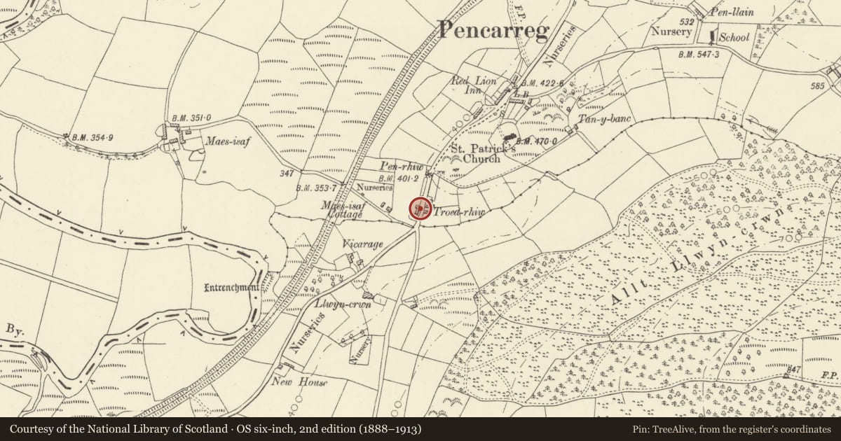
Slide toward Today to fade the historical sheet and see the modern map underneath.
David Rumsey Map Collection, Stanford LibrariesDavid Rumsey Map Collection, Stanford LibrariesDavid Rumsey Map Collection, Stanford LibrariesDavid Rumsey Map Collection, Stanford LibrariesDavid Rumsey Map Collection, Stanford Libraries
5 historical maps cover this location, the earliest the 1608 map "(13) Cambriae Typus." (David Rumsey Map Collection, Stanford Libraries).
Historical maps covering this location
- 1608 · (13) Cambriae Typus. (David Rumsey Map Collection, Stanford Libraries)
- 1830 · V.3:11-15:XV. Britisches Reich. A. Kon: England. b. Frstenthum Wales: Shire: 37-40 (David Rumsey Map Collection, Stanford Libraries)
- 1899 · 195 Lampeter (Hills) (David Rumsey Map Collection, Stanford Libraries)
- 1901 · Sheet 14. (David Rumsey Map Collection, Stanford Libraries)
- 1919 · Sheet 78. Lampeter. (David Rumsey Map Collection, Stanford Libraries)
Cadw's description
Location
Set down below the level of the road, approximately 250m SW of the parish church.
History
Probably C18, evidence for which is the gable stack, and shown on the 1841 Tithe map.
Exterior
A 2½-storey 3-window house of roughcast walls and slate roof. An external stack to the R gable end has been reduced to below the apex. The front has small 12-pane hornless sash windows in the upper storey, except for the L-hand which is fixed, and 9-pane sashes below flanking a panelled door incorporating glazed panels. The lower storey has 3 raked buttresses. In the R gable end is a 2-light casement window lower R. In the L gable end is a small attic window to the R, above a single-storey projection.
The 3-window projection, in 2 phases with slightly higher roof line above the R-hand window, is of rubble stone, with brick in the gable end, and concrete pantile roof. The R-hand window is a 12-pane hornless sash window. The other 2 windows are boarded up.
Interior
Not accessible at the time of inspection.
Reason for designation
Listed as an C18 house retaining strong historic character and detail.
Nearby in the register
- Pen-rhiwDomesticunder 1 mi
- Monument including railings to Daniel Evans (Daniel Ddu o Geredigion) in Pencarreg churchyardCommemorativeunder 1 mi
- Church of St PatrickReligious, Ritual and Funeraryunder 1 mi
- Plas CottageDomesticunder 1 mi
Other entries of the same register within about three miles of this one, by straight line.