Cof Cymru: National Historic Assets of Wales · Wales
Railway Station
Newtown and Llanllwchaiarn, Powys, Wales
A Grade II listed building in Newtown and Llanllwchaiarn, Powys, designated on 9 May 1988.
The record
- Designation
- Listed building, Grade II
- Broad class
- Transport
- Date of designation
- 9 May 1988
- Community
- Newtown and Llanllwchaiarn
- Unitary authority
- Powys
- Country
- Wales
- Coordinates
- 52.51230, -3.31158
- Cadw reference
- 8112
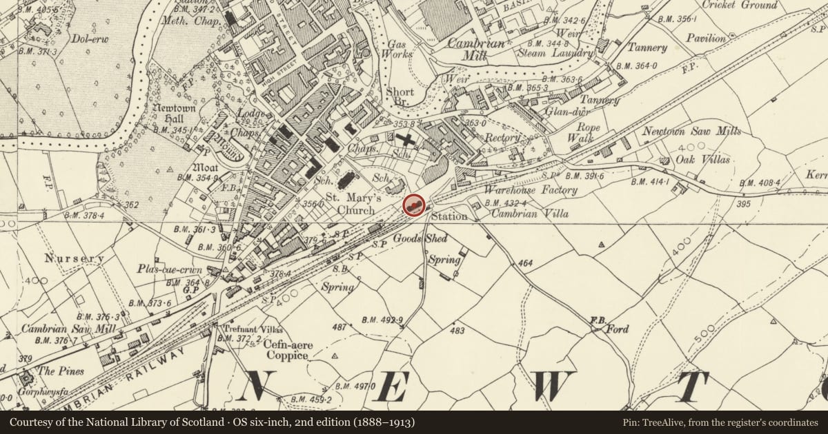
Slide toward Today to fade the historical sheet and see the modern map underneath.
David Rumsey Map Collection, Stanford LibrariesDavid Rumsey Map Collection, Stanford LibrariesDavid Rumsey Map Collection, Stanford LibrariesDavid Rumsey Map Collection, Stanford LibrariesDavid Rumsey Map Collection, Stanford Libraries
5 historical maps cover this location, the earliest the 1608 map "(13) Cambriae Typus." (David Rumsey Map Collection, Stanford Libraries).
Historical maps covering this location
- 1608 · (13) Cambriae Typus. (David Rumsey Map Collection, Stanford Libraries)
- 1637 · Particular description of Wales. Cambria seu Wallia (David Rumsey Map Collection, Stanford Libraries)
- 1883 · Watershed map England, Wales 3. (David Rumsey Map Collection, Stanford Libraries)
- 1899 · 165 Montgomery (Hills) (David Rumsey Map Collection, Stanford Libraries)
- 1901 · Sheet 14. (David Rumsey Map Collection, Stanford Libraries)
Cadw's description
Location
On the lane leading off Kerry Road between Agriculture House and the Royal Welsh Warehouse.
History
Built c1868 for the Cambrian Railway at a cost of £1,200 following complaints about the old station.
Exterior
Gothic, symmetrical entrance front with advanced gabled bays to ends, and porch to centre. Flemish bond brick on brick plinth. Steeply pitched slate roofs, crested ridge tiles. Bargeboards to advanced bays; pierced quatrafoils; finials and collared pendants to right. Brick stacks. Broad blue brick bands at window head and sill level, rising to pointed arches on advanced bays and porch. Stone window dressings, rusticated architraves. Foliate capitals to centre mullions on 2 light window. 1 light to outer bays and sides of advanced bays. Victorian sashes. Advanced porch to centre. Blue brick arch on detached columns, foliate capitals, large stone bases. Broad double doorway, stone lintel. "Gothic" panel doors and fanlight. Stone steps; later stone capped splayed side walls with foliated capitals.
Interesting platform seats with cast iron arborial bench ends.
Interior
Good interior to ticket office, original fittings. T & G panelling. Iron tension bars to trusses with cusped spandels.
Reason for designation
Group value.
Nearby in the register
- Royal Welsh WarehouseCommercialunder 1 mi
- Royal Welsh WarehouseCommercialunder 1 mi
- Agriculture HouseCommercialunder 1 mi
- Parish Church of St David including Wall Fronting New RoadReligious, Ritual and Funeraryunder 1 mi
Other entries of the same register within about three miles of this one, by straight line.