Cof Cymru: National Historic Assets of Wales · Wales
Agriculture House
Newtown and Llanllwchaiarn, Powys, Wales
A Grade II listed building in Newtown and Llanllwchaiarn, Powys, designated on 9 May 1988.
The record
- Designation
- Listed building, Grade II
- Broad class
- Commercial
- Date of designation
- 9 May 1988
- Community
- Newtown and Llanllwchaiarn
- Unitary authority
- Powys
- Country
- Wales
- Coordinates
- 52.51292, -3.31013
- Cadw reference
- 8111
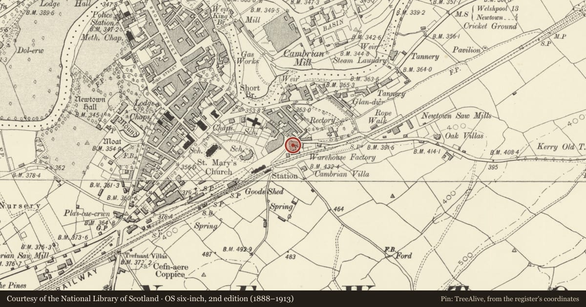
Slide toward Today to fade the historical sheet and see the modern map underneath.
David Rumsey Map Collection, Stanford LibrariesDavid Rumsey Map Collection, Stanford LibrariesDavid Rumsey Map Collection, Stanford LibrariesDavid Rumsey Map Collection, Stanford LibrariesDavid Rumsey Map Collection, Stanford Libraries
5 historical maps cover this location, the earliest the 1608 map "(13) Cambriae Typus." (David Rumsey Map Collection, Stanford Libraries).
Historical maps covering this location
- 1608 · (13) Cambriae Typus. (David Rumsey Map Collection, Stanford Libraries)
- 1637 · Particular description of Wales. Cambria seu Wallia (David Rumsey Map Collection, Stanford Libraries)
- 1883 · Watershed map England, Wales 3. (David Rumsey Map Collection, Stanford Libraries)
- 1899 · 165 Montgomery (Hills) (David Rumsey Map Collection, Stanford Libraries)
- 1901 · Sheet 14. (David Rumsey Map Collection, Stanford Libraries)
Cadw's description
Location
Prominently sited opposite the Royal Welsh Warehouse on the junction of Kerry Road with the lane leading to the Railway Station.
History
Built 1895 as a factory for Pryce Jones on the site of an earlier one. Served as Admiralty victualling station during World War II. Taken over by the Agricultural Executive Committee and later ADAS.
Exterior
5 storey and attic red brick with stock brick bands. V-shaped with principal elevation to Railway Station. Gabled slate roofs, eaves cornice. 9 bay front. Gabled dormer bearing date 1895 over 2nd to 4th bays from right. Paired shallow sash windows to attic storey. Attic cornice, broad stock brick entablature. 3rd and 4th floor windows between pilasters over 3rd floor band. Keystones to cambered arches, small paned cross windows. Similar to 2nd and 1st floor. Plain cambered arches to ground floor. Dummy windows to right end wall flank brick stack. Similar elevation to Kerry Rd with broad carriageway to left. Recessed canted bay to corner, similar fenestration. Freestone doorcase. Trucated pilasters on brackets carry finials. Rectangular panel with dragons passant supporting arms of Gwynedd. Keystoned round arched doorway. A bridge formerly linked this corner at 3rd floor level to the 1901 extension of the Royal Welsh Warehouse.
Reason for designation
Group Value.
Nearby in the register
- Royal Welsh WarehouseCommercialunder 1 mi
- Royal Welsh WarehouseCommercialunder 1 mi
- Former Servants Wing at the RectoryDomesticunder 1 mi
- Railway StationTransportunder 1 mi
Other entries of the same register within about three miles of this one, by straight line.