Cof Cymru: National Historic Assets of Wales · Wales
Field Barn
Llanfair, Gwynedd, Wales
A Grade II listed building in Llanfair, Gwynedd, designated on 23 May 2003.
The record
- Designation
- Listed building, Grade II
- Broad class
- Agriculture and Subsistence
- Date of designation
- 23 May 2003
- Locality
- Llanfair
- Community
- Llanfair
- Unitary authority
- Gwynedd
- Country
- Wales
- Coordinates
- 52.84970, -4.09728
- Cadw reference
- 81078
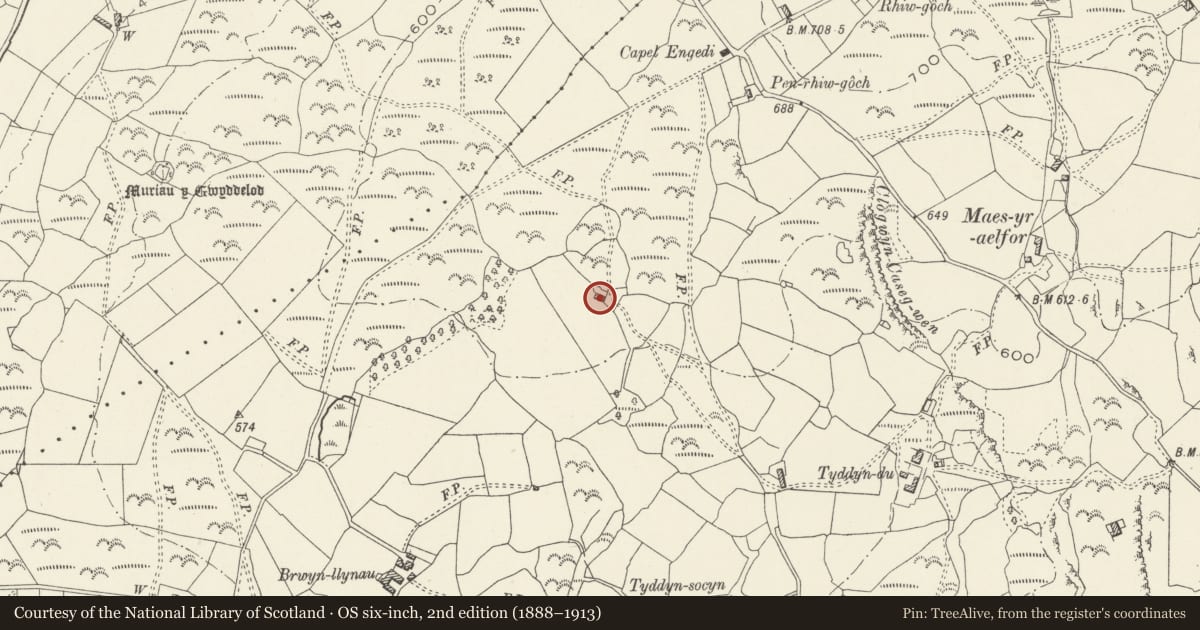
Slide toward Today to fade the historical sheet and see the modern map underneath.
David Rumsey Map Collection, Stanford LibrariesDavid Rumsey Map Collection, Stanford LibrariesDavid Rumsey Map Collection, Stanford LibrariesLlyfrgell Genedlaethol Cymru – The National Library of WalesDavid Rumsey Map Collection, Stanford Libraries
5 historical maps cover this location, the earliest the 1795 map "To Sir Watkin Williams-Wynn Bart ... the map of the six counties of North Wales is most humbly inscribed by his obedient humble servant" (Llyfrgell Genedlaethol Cymru – The National Library of Wales).
Historical maps covering this location
- 1795 · To Sir Watkin Williams-Wynn Bart ... the map of the six counties of North Wales is most… (Llyfrgell Genedlaethol Cymru – The National Library of Wales)
- 1883 · Watershed map England, Wales 3. (David Rumsey Map Collection, Stanford Libraries)
- 1896 · Sheet 7. Ordnance Survey of England and Wales. (David Rumsey Map Collection, Stanford Libraries)
- 1899 · 135 Harlech (Hills) (David Rumsey Map Collection, Stanford Libraries)
- 1901 · Sheet 9 and 10. (David Rumsey Map Collection, Stanford Libraries)
Cadw's description
Location
In an isolated location reached by a farm track leading S off the mountain road that runs NE from the coast at Llanfair, just before the crossroads SE of Harlech.
History
C18 or C19 field barn, not shown on the tithe map of the parish, 1849; it''s isolated location, well away from the nearest farmstead, may have been one reason for not being annotated on the map. Formed part of the extensive farmstead at Tyddyn Du.
Exterior
Vernacular field barn aligned NW-SE built of rubble masonry; slate roof with stone copings. There is a doorway along the NE lateral wall and a pitching hole set in the NW gable apex.
Interior
Interior not inspected at the time of the survey.
Reason for designation
Included as a good example of a vernacular field barn characteristic of the upland farmstead of the region.
Nearby in the register
- Tyddyn Du Enclosed SettlementEnclosed hut circleunder 1 mi
- Muriau'r Gwyddelod Ancient VillageCourtyard houseunder 1 mi
- Brwyn-Llynau Enclosed SettlementEnclosureunder 1 mi
- Enclosure and Early Field System North of Fronhill, LlanfairField Systemunder 1 mi
Other entries of the same register within about three miles of this one, by straight line.