Cof Cymru: National Historic Assets of Wales · Wales
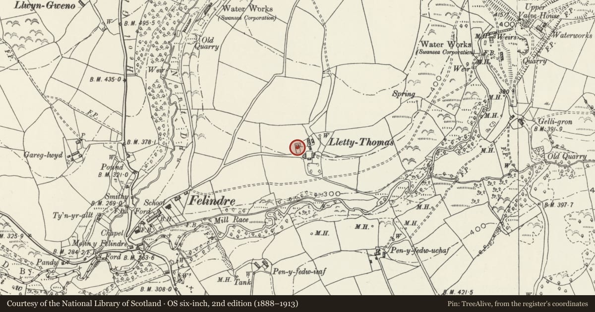
Llety Thomas
Mawr, Swansea, Wales
A Grade II listed building in Felindre, Swansea, Mawr, designated on 23 May 2003.
The record
- Designation
- Listed building, Grade II
- Broad class
- Domestic
- Date of designation
- 23 May 2003
- Locality
- Felindre
- Town
- Swansea
- Community
- Mawr
- Unitary authority
- Swansea
- Country
- Wales
- Coordinates
- 51.70939, -3.96647
- Cadw reference
- 81065
Slide toward Today to fade the historical sheet and see the modern map underneath.
David Rumsey Map Collection, Stanford LibrariesDavid Rumsey Map Collection, Stanford LibrariesDavid Rumsey Map Collection, Stanford LibrariesDavid Rumsey Map Collection, Stanford LibrariesDavid Rumsey Map Collection, Stanford Libraries
5 historical maps cover this location, the earliest the 1636 map "Cornubia : Devonia, Somersetus, Dorcestria, Wiltonia, Glocestria ..." (David Rumsey Map Collection, Stanford Libraries).
Historical maps covering this location
- 1636 · Cornubia : Devonia, Somersetus, Dorcestria, Wiltonia, Glocestria ... (David Rumsey Map Collection, Stanford Libraries)
- 1637 · The fourth table of England. Cornub. Devonia, Somerset etc. (David Rumsey Map Collection, Stanford Libraries)
- 1891 · Sheet 10. Ordnance Survey of England and Wales. . (David Rumsey Map Collection, Stanford Libraries)
- 1898 · 230 Ammanford (Hills) (David Rumsey Map Collection, Stanford Libraries)
- 1920 · Sheet 100. Llanelly. (David Rumsey Map Collection, Stanford Libraries)
Cadw's description
Location
Situated some half kilometre NE of Felindre, down drive running W from dead-end lane towards Banc Myddfai.
History
Late C18 minor gentry house of typical centralised plan with service rooms under outshut rear roof. Much altered in mid to later C19 with concrete tiles for slates and altered windows for small-pane sashes but essentially intact.
Exterior
Farmhouse, rendered stone with asbestos-sheet close-eaved roof with rendered end stacks. Two storeys and attic, three-window range with centre small gable over pointed attic window which breaks eaves. Renewed earlier C20 4-pane sashes, gabled centre porch with concrete tiles and pointed entry. C19 4-panel door within, with chamfered and stopped edges to panels. Rendered right end wall, outshut rear with 2 storey lower elevation, 2 windows above, 4 windows and centre door below, all mid C20 replacements. Chimney on outshut E end, with tall brick rebuilt shaft.
Interior
Not inspected.
Reason for designation
Included as late C18 formal fronted house with unusual pointed heads to porch entry and attic gable window.
Nearby in the register
- The Water Mill / Melin FelindreIndustrialunder 1 mi
- Earthwork 1080m NNW of Fforest NewyddEnclosureunder 1 mi
- Mynydd Pysgodlyn Round BarrowRound Barrow1 mi
- Pant-y-Ffa Round CairnRound Cairn1 mi
Other entries of the same register within about three miles of this one, by straight line.