Cof Cymru: National Historic Assets of Wales · Wales
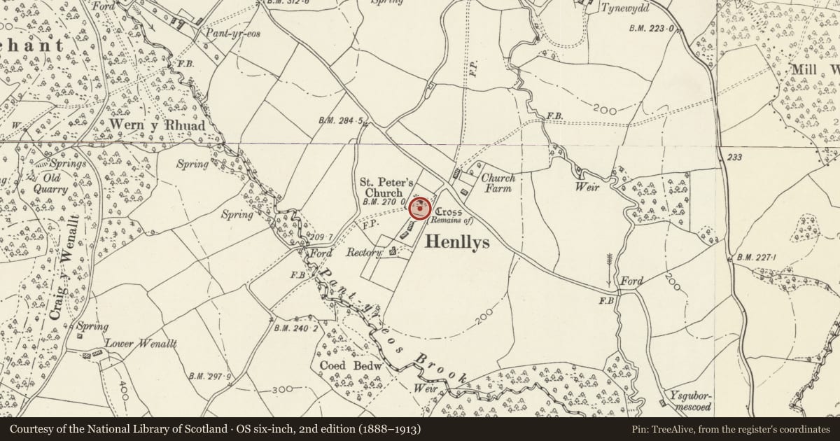
Remains of churchyard cross, Church of Saint Peter
Henllys, Torfaen, Wales
A Grade II listed building in Henllys, Cwmbran, Torfaen, designated on 24 April 2003.
The record
- Designation
- Listed building, Grade II
- Broad class
- Religious, Ritual and Funerary
- Date of designation
- 24 April 2003
- Locality
- Henllys
- Town
- Cwmbran
- Community
- Henllys
- Unitary authority
- Torfaen
- Country
- Wales
- Coordinates
- 51.61320, -3.05910
- Cadw reference
- 81035
Slide toward Today to fade the historical sheet and see the modern map underneath.
David Rumsey Map Collection, Stanford LibrariesDavid Rumsey Map Collection, Stanford LibrariesDavid Rumsey Map Collection, Stanford LibrariesDavid Rumsey Map Collection, Stanford LibrariesDavid Rumsey Map Collection, Stanford Libraries
5 historical maps cover this location, the earliest the 1636 map "Cornubia : Devonia, Somersetus, Dorcestria, Wiltonia, Glocestria ..." (David Rumsey Map Collection, Stanford Libraries).
Historical maps covering this location
- 1636 · Cornubia : Devonia, Somersetus, Dorcestria, Wiltonia, Glocestria ... (David Rumsey Map Collection, Stanford Libraries)
- 1865 · England and Wales. England No. 6. (David Rumsey Map Collection, Stanford Libraries)
- 1895 · Sheet 11. Ordnance Survey of England and Wales. (David Rumsey Map Collection, Stanford Libraries)
- 1906 · 249 Newport (Hills) (David Rumsey Map Collection, Stanford Libraries)
- 1913 · Sheet 102. Newport. (David Rumsey Map Collection, Stanford Libraries)
Cadw's description
Location
Situated in the churchyard of Church of Saint Peter some 12m S of the porch.
History
Medieval cross base raised on steps. Repaired probably in C19.
Exterior
Base of churchyard cross, single stone square pedestal broached with keel-shaped broaches to octagonal, with truncated base of shaft also broached to octagonal with similar broaches. Cross is raised on 4 steps with squared blocks to risers and large coping stones to treads, lower copings with moulded edge. The lowest 2 steps are high, the other steps are of diminishing height. Signs of C19 repairs using old gravestones on S side.
Reason for designation
Included as substantial remains of a medieval churchyard cross. Group value with Church of Saint Peter.
Scheduled Ancient Monument, Cadw Ref No MM309.
Nearby in the register
- St. Peter's Churchyard Cross, HenllysCrossunder 1 mi
- Church of Saint PeterReligious, Ritual and Funeraryunder 1 mi
- Round Cairn 315m S of Upper WenalltRound Cairnunder 1 mi
- Canal Bridge over Monmouthshire and Brecon Canal E of Pen y vanTransportunder 1 mi
Other entries of the same register within about three miles of this one, by straight line.