Cof Cymru: National Historic Assets of Wales · Wales
Canal Bridge over Monmouthshire and Brecon Canal E of Pen y van
Rogerstone, Newport, Wales
A Grade II listed building in Pontymister, Rogerstone, Newport, designated on 22 October 1999.
The record
- Designation
- Listed building, Grade II
- Broad class
- Transport
- Date of designation
- 22 October 1999
- Locality
- Pontymister
- Community
- Rogerstone
- Unitary authority
- Newport
- Country
- Wales
- Coordinates
- 51.60233, -3.07175
- Cadw reference
- 22513
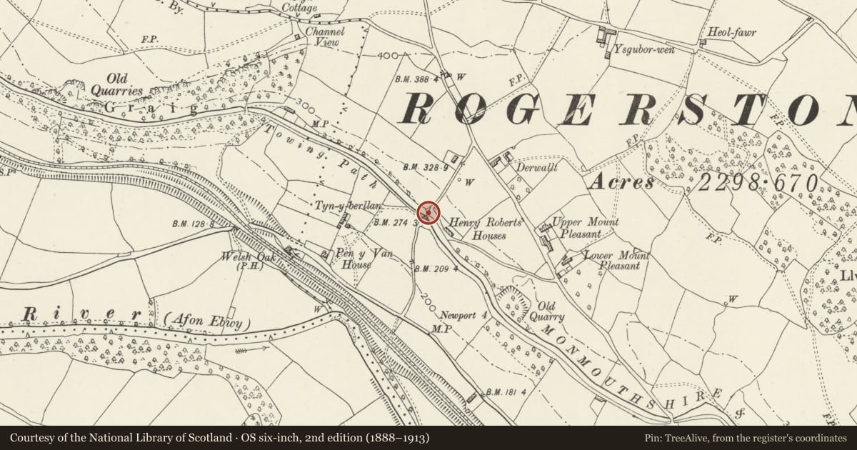
Slide toward Today to fade the historical sheet and see the modern map underneath.
David Rumsey Map Collection, Stanford LibrariesDavid Rumsey Map Collection, Stanford LibrariesDavid Rumsey Map Collection, Stanford LibrariesDavid Rumsey Map Collection, Stanford LibrariesDavid Rumsey Map Collection, Stanford Libraries
5 historical maps cover this location, the earliest the 1636 map "Cornubia : Devonia, Somersetus, Dorcestria, Wiltonia, Glocestria ..." (David Rumsey Map Collection, Stanford Libraries).
Historical maps covering this location
- 1636 · Cornubia : Devonia, Somersetus, Dorcestria, Wiltonia, Glocestria ... (David Rumsey Map Collection, Stanford Libraries)
- 1865 · England and Wales. England No. 6. (David Rumsey Map Collection, Stanford Libraries)
- 1895 · Sheet 11. Ordnance Survey of England and Wales. (David Rumsey Map Collection, Stanford Libraries)
- 1906 · 249 Newport (Hills) (David Rumsey Map Collection, Stanford Libraries)
- 1913 · Sheet 102. Newport. (David Rumsey Map Collection, Stanford Libraries)
Cadw's description
Location
On the boundary with Graig Community, E of Pontymister, on lane leading due N from Risca Road.
History
In 1790s a consortium of coal owners and industrialists sought Parliamentary approval to build canals to link the industrial areas of the N valleys with Newport on the Usk estuary, the canals in turn to link with a system of feeder tramroads. Bill received assent in 1792 and the Monmouthshire Canal Navigation Company was formed to build two canals; that in the Western Valley, also known as the Crumlin Arm and 11 miles long, was designed to join the Eastern Valley Canal just N of Newport, completed c 1797, engineer Thomas Dadford. Reservoirs to feed canal were constructed in mountain valleys. In 1865 the Brecknock and Abergavenny and Monmouthshire Canals merged to become the Monmouthshire and Brecon Canal which was later incorporated into the Great Western Railway. Much of the Western Valley canal was filled in to provide a by-pass road but the section through Risca mostly survives, continuing on from the surviving Crosskeys section. The Sirhowy tramroad built at the expense of the Sirhowy and Tredegar ironmasters from their furnaces in the north valleys to Nine Mile Point, at the bottom of the Sirhowy Valley, N of Risca was completed 1805, linking with the Monmouthshire Railway and Canal Company tramroad via the Long Bridge, crossing the Ebbw Valley.
Exterior
Hump-backed bridge of rubble sandstone. Single elliptical arch has dressed stone voussoirs and low parapet with flat coping. Abutments splayed outwards end in square piers. Former tow path passed under bridge on S side. Tarmac deck. Repairs in concrete to coping and ends.
Reason for designation
Listed as a late C18 canal bridge retaining its character.
Nearby in the register
- Canal Bridge over Monmouthshire and Brecon Canal E of Pen y van (partly in Risca community)Transportunder 1 mi
- Pen-y-van including attached range to leftDomesticunder 1 mi
- Canal Bridge over Monmouthshire and Brecon Canal S of Ty SignTransportunder 1 mi
- Round Cairn 315m S of Upper WenalltRound Cairnunder 1 mi
Other entries of the same register within about three miles of this one, by straight line.