Cof Cymru: National Historic Assets of Wales · Wales
Cresselly Arms
Llanegwad, Carmarthenshire, Wales
A Grade II listed building in Pontargothi, Llanegwad, Carmarthenshire, designated on 1 April 2003.
The record
- Designation
- Listed building, Grade II
- Broad class
- Commercial
- Date of designation
- 1 April 2003
- Locality
- Pontargothi
- Community
- Llanegwad
- Unitary authority
- Carmarthenshire
- Country
- Wales
- Coordinates
- 51.87445, -4.17209
- Cadw reference
- 81013
Slide toward Today to fade the historical sheet and see the modern map underneath.
David Rumsey Map Collection, Stanford LibrariesDavid Rumsey Map Collection, Stanford LibrariesDavid Rumsey Map Collection, Stanford LibrariesDavid Rumsey Map Collection, Stanford LibrariesDavid Rumsey Map Collection, Stanford Libraries
5 historical maps cover this location, the earliest the 1636 map "Cornubia : Devonia, Somersetus, Dorcestria, Wiltonia, Glocestria ..." (David Rumsey Map Collection, Stanford Libraries).
Historical maps covering this location
- 1636 · Cornubia : Devonia, Somersetus, Dorcestria, Wiltonia, Glocestria ... (David Rumsey Map Collection, Stanford Libraries)
- 1860 · 41. Caermathen. (David Rumsey Map Collection, Stanford Libraries)
- 1891 · Sheet 10. Ordnance Survey of England and Wales. . (David Rumsey Map Collection, Stanford Libraries)
- 1898 · 212 Llandovery (Outline) (David Rumsey Map Collection, Stanford Libraries)
- 1901 · Sheet 14. (David Rumsey Map Collection, Stanford Libraries)
Cadw's description
Location
Abutting the NE side of Pont-ar-Gothi.
History
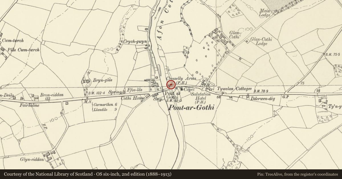
A Cresselly Arms existed on the site by 1839 and is shown on the 1839 Tithe map, but the present building was built in the mid C19 and is first shown on the 1888 Ordnance Survey.
Exterior
A 2-storey 3-window public house of rendered rubble-stone walls and slate roof with end stack to the R and external stack to the L. The upper storey has applied ''''timber framing''''. Openings are offset to the L. The central boarded door has a doorcase with consoles, and is flanked by 4-pane sash windows. A link to the R side is attached to a further range at R angles, perhaps the original building but modernised. Against the R gable end is a lower gabled projection, possibly originally a kitchen. The rear has inserted and replaced windows, and is splayed on the L side.
Reason for designation
Listed as an historic public house retaining late Georgian character in a prominent location abutting Pont ar Gothi.
Nearby in the register
- Pont-ar-GothiTransportunder 1 mi
- Church of the Holy TrinityReligious, Ritual and Funeraryunder 1 mi
- Pen y Cnap CastleMotteunder 1 mi
- Ffynnon-Newydd Standing StonesHengeunder 1 mi
Other entries of the same register within about three miles of this one, by straight line.