Cof Cymru: National Historic Assets of Wales · Wales
Pont-ar-Gothi
Llanegwad, Carmarthenshire, Wales
A Grade II listed building in Pontargothi, Llanegwad, Carmarthenshire, designated on 8 July 1966.
The record
- Designation
- Listed building, Grade II
- Broad class
- Transport
- Date of designation
- 8 July 1966
- Locality
- Pontargothi
- Community
- Llanegwad
- Unitary authority
- Carmarthenshire
- Country
- Wales
- Coordinates
- 51.87423, -4.17246
- Cadw reference
- 22708
Slide toward Today to fade the historical sheet and see the modern map underneath.
David Rumsey Map Collection, Stanford LibrariesDavid Rumsey Map Collection, Stanford LibrariesDavid Rumsey Map Collection, Stanford LibrariesDavid Rumsey Map Collection, Stanford LibrariesDavid Rumsey Map Collection, Stanford Libraries
5 historical maps cover this location, the earliest the 1636 map "Cornubia : Devonia, Somersetus, Dorcestria, Wiltonia, Glocestria ..." (David Rumsey Map Collection, Stanford Libraries).
Historical maps covering this location
- 1636 · Cornubia : Devonia, Somersetus, Dorcestria, Wiltonia, Glocestria ... (David Rumsey Map Collection, Stanford Libraries)
- 1860 · 41. Caermathen. (David Rumsey Map Collection, Stanford Libraries)
- 1891 · Sheet 10. Ordnance Survey of England and Wales. . (David Rumsey Map Collection, Stanford Libraries)
- 1898 · 212 Llandovery (Outline) (David Rumsey Map Collection, Stanford Libraries)
- 1901 · Sheet 14. (David Rumsey Map Collection, Stanford Libraries)
Cadw's description
Location
Spanning Afon Cothi in the centre of Pontargothi.
History
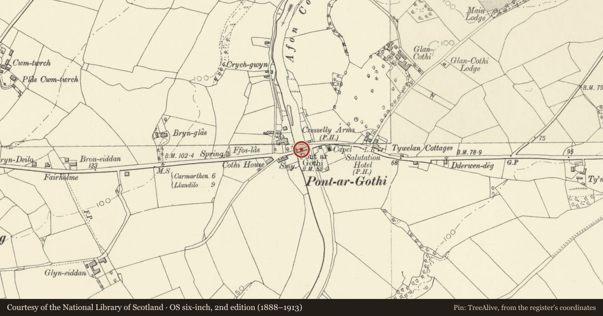
An C18 or early C19 bridge shown on the 1839 Tithe map and 1888 Ordnance Survey as single carriageway. It was widened in the late C19 to a double carriageway.
Exterior
A rubble-stone triple-span double-carriageway bridge in 2 phases separated by a butt joint visible in the underside of the bridge. Segmental arches have narrow voussoirs. The upstream (N) side is the earlier. It has V-shaped cutwaters carried up to the parapet to form refuges. The coped parapet is corbelled out. The abutment on the R bank has a V-shaped buttress; the L side abuts the Cresselly Arms. On the wider S side, stepped V-shaped cutwaters have pyramidal offsets below a band at the base of the coped parapet. The plain abutments have shallow stepped buttresses.
Reason for designation
Listed as a fine C18 road bridge with significant C19 widening.
Nearby in the register
- Cresselly ArmsCommercialunder 1 mi
- Church of the Holy TrinityReligious, Ritual and Funeraryunder 1 mi
- Pen y Cnap CastleMotteunder 1 mi
- Ffynnon-Newydd Standing StonesHengeunder 1 mi
Other entries of the same register within about three miles of this one, by straight line.