Cof Cymru: National Historic Assets of Wales · Wales
Ty'n Rhos Cottage
Llanddona, Isle of Anglesey, Wales
A Grade II listed building in Llaniestyn, Llanddona, Isle of Anglesey, designated on 12 March 2003.
The record
- Designation
- Listed building, Grade II
- Broad class
- Domestic
- Date of designation
- 12 March 2003
- Locality
- Llaniestyn
- Community
- Llanddona
- Unitary authority
- Isle of Anglesey
- Country
- Wales
- Coordinates
- 53.29247, -4.12759
- Cadw reference
- 80971
Slide toward Today to fade the historical sheet and see the modern map underneath.
David Rumsey Map Collection, Stanford LibrariesDavid Rumsey Map Collection, Stanford LibrariesDavid Rumsey Map Collection, Stanford LibrariesDavid Rumsey Map Collection, Stanford LibrariesDavid Rumsey Map Collection, Stanford Libraries
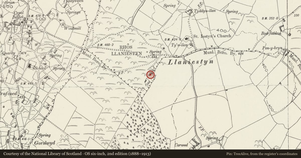
5 historical maps cover this location, the earliest the 1883 map "Watershed map England, Wales 3." (David Rumsey Map Collection, Stanford Libraries).
Historical maps covering this location
- 1883 · Watershed map England, Wales 3. (David Rumsey Map Collection, Stanford Libraries)
- 1896 · Sheet 7. Ordnance Survey of England and Wales. (David Rumsey Map Collection, Stanford Libraries)
- 1899 · 94 Beaumaris (Hills) (David Rumsey Map Collection, Stanford Libraries)
- 1901 · Sheet 9 and 10. (David Rumsey Map Collection, Stanford Libraries)
- 1919 · Sheet 41. Anglesey. (David Rumsey Map Collection, Stanford Libraries)
Cadw's description
Location
In a rural location, set back from a small country lane leading S off the lane E out of the village of Llanddona to the Church of St Iestyn; the cottage is c0.25km SW of the church, and at S edge of the common at Rhos Iestyn.
History
Llanddona is a sprawling settlement, with the church and surrounding small hamlet based at the foot of the hillside along the beach at Red Wharf Bay, extended by small squatter dwellings set amongst the heathland at the top of the hill and with similar dwellings to E built within the common land of Llaniestyn. The main period of growth for the village being in the mid-late C19, Ty''n Rhos Cottage is probably of this date as the Tithe Apportionment for the parish, 1849, does not mention a separate dwelling, Ty''n Rhos is listed as common land of 39 acres(15.8 hectares).
Exterior
Croglofft cottage of rubble masonry, limewashed; roof of small slates, heavily grouted, with rectangular rubble stacks with dripstones and capping. The main part of the cottage is a 2-window range with central doorway now in a flat roofed porch; flanking windows are small 4-pane horned sashes and there is a single similar window to rear (L). To L end is a single window range with unequal horned sash of 6-panes, possibly a converted cowhouse. At R end is a lean-to outbuilding with single boarded door and roof of profiled metal.
Interior
The interior was not inspected at the time of the survey.
Reason for designation
Listed as a well-preserved mid C19 croglofft cottage, a typical example of a squatter cottage of a type once common in the area but now rare. The range retains a strong vernacular character in the retention of the roof of small slates and original fenestration.
Nearby in the register
- Church of St IestynReligious, Ritual and Funeraryunder 1 mi
- Cefn LlechDomesticunder 1 mi
- Hut Circle W of Buarth CyttirUnenclosed hut circleunder 1 mi
- Boiling house at Tyddyn IsafDomesticunder 1 mi
Other entries of the same register within about three miles of this one, by straight line.