Cof Cymru: National Historic Assets of Wales · Wales
Blaenygarth
Pant, Merthyr Tydfil, Wales
A Grade II listed building in Pant, Merthyr Tydfil, designated on 11 March 2003.
The record
- Designation
- Listed building, Grade II
- Broad class
- Domestic
- Date of designation
- 11 March 2003
- Locality
- Pant
- Community
- Pant
- Unitary authority
- Merthyr Tydfil
- Country
- Wales
- Coordinates
- 51.77883, -3.36300
- Cadw reference
- 80959
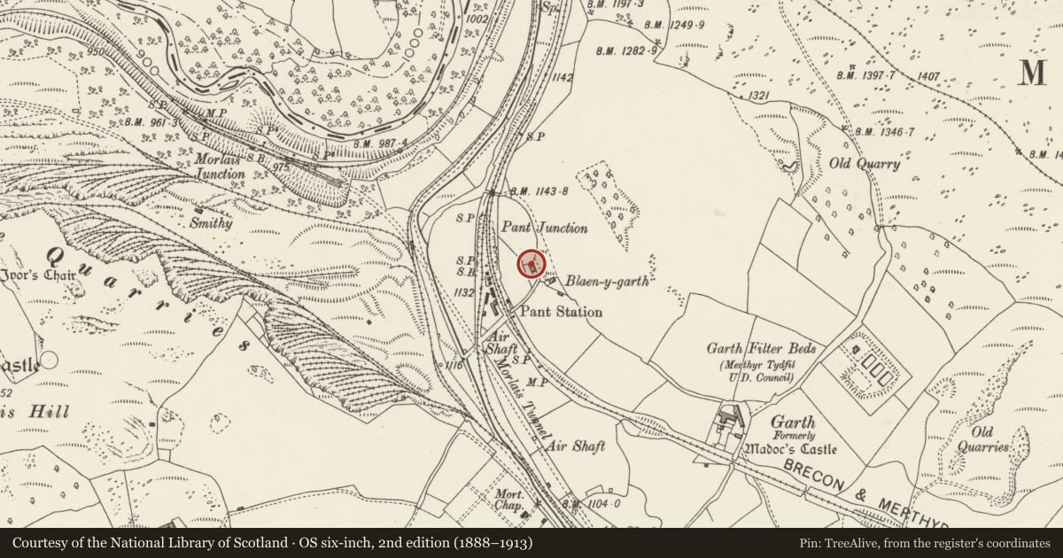
Slide toward Today to fade the historical sheet and see the modern map underneath.
David Rumsey Map Collection, Stanford LibrariesDavid Rumsey Map Collection, Stanford LibrariesDavid Rumsey Map Collection, Stanford LibrariesDavid Rumsey Map Collection, Stanford LibrariesDavid Rumsey Map Collection, Stanford Libraries
5 historical maps cover this location, the earliest the 1636 map "Cornubia : Devonia, Somersetus, Dorcestria, Wiltonia, Glocestria ..." (David Rumsey Map Collection, Stanford Libraries).
Historical maps covering this location
- 1636 · Cornubia : Devonia, Somersetus, Dorcestria, Wiltonia, Glocestria ... (David Rumsey Map Collection, Stanford Libraries)
- 1830 · V.3:11-15:XV. Britisches Reich. A. Kon: England. b. Frstenthum Wales: Shire: 37-40 (David Rumsey Map Collection, Stanford Libraries)
- 1856 · 42. Brecon. (David Rumsey Map Collection, Stanford Libraries)
- 1895 · Sheet 11. Ordnance Survey of England and Wales. (David Rumsey Map Collection, Stanford Libraries)
- 1898 · 231 Merthyr Tydfil (Hills) (David Rumsey Map Collection, Stanford Libraries)
Cadw's description
Location
Situated on the N side of Pant some 150m NE of Pant station of the Brecon Mountain Railway.
History
Small single storey farmhouse of mid to later C19 date, probably rebuilt on an older site. Part of the larger Castle Farm, formerly owned by the Plymouth estate.
Exterior
Small farmhouse whitewashed rubble stone with brick dressings and slate close-eaved roof with yellow brick end stacks, left end stack truncated. Single storey, with door between 2 windows to right half and single 12-pane horned sash central to left half. Right half has enclosed gabled porch between 2 narrow windows with tilting top lights. Stone sills.
Rear has cambered-headed doorway with boarded door to centre left, hornless 12-pane sash to centre right with lean-to to right. Small added lean-to outhouse to left.
Interior
Not available for inspection.
Reason for designation
Included as a rare surviving single-storey farmhouse of definite quality and character.
Nearby in the register
- Centre ventilation shaft to Morlais TunnelTransportunder 1 mi
- SE Ventilation Shaft to Morlais TunnelTransportunder 1 mi
- Morlais Hill ring cairnRing Cairnunder 1 mi
- The War Memorial, screen walls and surrounding railingsCommemorativeunder 1 mi
Other entries of the same register within about three miles of this one, by straight line.