Cof Cymru: National Historic Assets of Wales · Wales
Llanwddyn War Memorial
Llanwddyn, Powys, Wales
A Grade II listed building in Cynon-isaf, Llanwddyn, Powys, designated on 26 February 2003.
The record
- Designation
- Listed building, Grade II
- Broad class
- Commemorative
- Date of designation
- 26 February 2003
- Locality
- Cynon-isaf
- Community
- Llanwddyn
- Unitary authority
- Powys
- Country
- Wales
- Coordinates
- 52.76114, -3.45123
- Cadw reference
- 80918
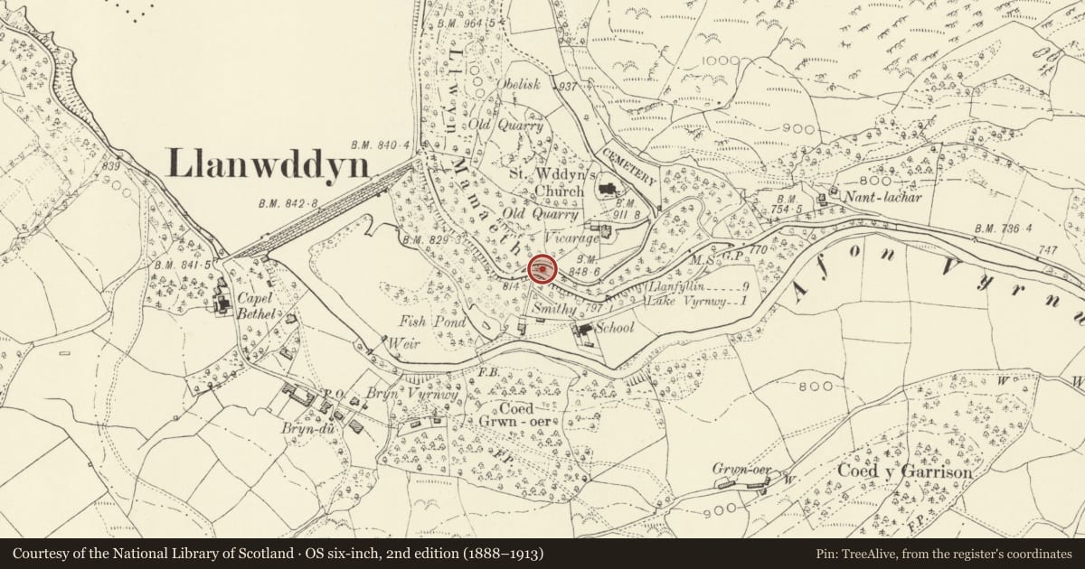
Slide toward Today to fade the historical sheet and see the modern map underneath.
David Rumsey Map Collection, Stanford LibrariesDavid Rumsey Map Collection, Stanford LibrariesLlyfrgell Genedlaethol Cymru – The National Library of WalesDavid Rumsey Map Collection, Stanford LibrariesDavid Rumsey Map Collection, Stanford Libraries
5 historical maps cover this location, the earliest the 1608 map "(13) Cambriae Typus." (David Rumsey Map Collection, Stanford Libraries).
Historical maps covering this location
- 1608 · (13) Cambriae Typus. (David Rumsey Map Collection, Stanford Libraries)
- 1795 · To Sir Watkin Williams-Wynn Bart ... the map of the six counties of North Wales is most… (Llyfrgell Genedlaethol Cymru – The National Library of Wales)
- 1883 · Watershed map England, Wales 3. (David Rumsey Map Collection, Stanford Libraries)
- 1899 · 136 Bala (Hills) (David Rumsey Map Collection, Stanford Libraries)
- 1901 · Sheet 9 and 10. (David Rumsey Map Collection, Stanford Libraries)
Cadw's description
Location
To the north side of the road from Abertridwr to Lake Vyrnwy, near the side road to St Wddyn's church.
History
A memorial set up after the Great War.
Exterior
A war memorial to the fallen of this parish in the Great War, in the form of a Celtic Cross with interlace pattern on the face and a slightly tapering shaft, standing on a die upon which the names of the deceased are carved. Additional names commemorate those lost from this parish in the Second World War.
The cross stands at the centre of a semicircular recess in the bank at the roadside, with a paved surround, a drystone retaining wall at rear and protective railings and gates at front.
Reason for designation
Listed for group value with the other listed buildings of Llanwddyn village.
Nearby in the register
- Workshops attached to nos. 3-6, Glanrafon, LlanwddynIndustrialunder 1 mi
- No. 4 Glanrafon, LlanwddynDomesticunder 1 mi
- No. 5 Glanrafon, LlanwddynDomesticunder 1 mi
- No. 3 Glanrafon, LlanwddynDomesticunder 1 mi
Other entries of the same register within about three miles of this one, by straight line.