Cof Cymru: National Historic Assets of Wales · Wales
No. 4 Glanrafon, Llanwddyn
Llanwddyn, Powys, Wales
A Grade II listed building in Glanrafon, Llanwddyn, Powys, designated on 26 February 2003.
The record
- Designation
- Listed building, Grade II
- Broad class
- Domestic
- Date of designation
- 26 February 2003
- Locality
- Glanrafon
- Community
- Llanwddyn
- Unitary authority
- Powys
- Country
- Wales
- Coordinates
- 52.76041, -3.45143
- Cadw reference
- 80926
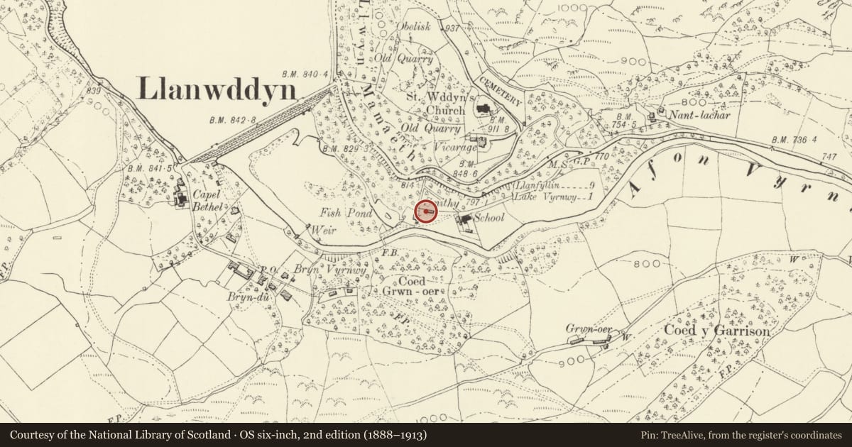
Slide toward Today to fade the historical sheet and see the modern map underneath.
David Rumsey Map Collection, Stanford LibrariesDavid Rumsey Map Collection, Stanford LibrariesLlyfrgell Genedlaethol Cymru – The National Library of WalesDavid Rumsey Map Collection, Stanford LibrariesDavid Rumsey Map Collection, Stanford Libraries
5 historical maps cover this location, the earliest the 1608 map "(13) Cambriae Typus." (David Rumsey Map Collection, Stanford Libraries).
Historical maps covering this location
- 1608 · (13) Cambriae Typus. (David Rumsey Map Collection, Stanford Libraries)
- 1795 · To Sir Watkin Williams-Wynn Bart ... the map of the six counties of North Wales is most… (Llyfrgell Genedlaethol Cymru – The National Library of Wales)
- 1883 · Watershed map England, Wales 3. (David Rumsey Map Collection, Stanford Libraries)
- 1899 · 136 Bala (Hills) (David Rumsey Map Collection, Stanford Libraries)
- 1901 · Sheet 9 and 10. (David Rumsey Map Collection, Stanford Libraries)
Cadw's description
Location
In the valley 300 m south-east of the Vyrnwy Dam.
History
One of a set of four cottages with attached workshops probably built c.1900, as workers housing for the employees at the reservoir. The workshops have lost a chimney or ventilator at the centre of their main roof.
Exterior
The second cottage from the left (west) of the terrace.
Reason for designation
Part of a terrace of cottages with workshops related to the new community based on the Vyrnwy Reservoir. A composed group of cottages of picturesque character, which have been carefully conserved.
Nearby in the register
- No. 3 Glanrafon, LlanwddynDomesticunder 1 mi
- No. 5 Glanrafon, LlanwddynDomesticunder 1 mi
- No. 6 Glanrafon, LlanwddynDomesticunder 1 mi
- Workshops attached to nos. 3-6, Glanrafon, LlanwddynIndustrialunder 1 mi
Other entries of the same register within about three miles of this one, by straight line.