Cof Cymru: National Historic Assets of Wales · Wales
Hearse house at St Wddyn's Churchyard
Llanwddyn, Powys, Wales
A Grade II listed building in Cynon-isaf, Llanwddyn, Powys, designated on 26 February 2003.
The record
- Designation
- Listed building, Grade II
- Broad class
- Religious, Ritual and Funerary
- Date of designation
- 26 February 2003
- Locality
- Cynon-isaf
- Community
- Llanwddyn
- Unitary authority
- Powys
- Country
- Wales
- Coordinates
- 52.76201, -3.44847
- Cadw reference
- 80915
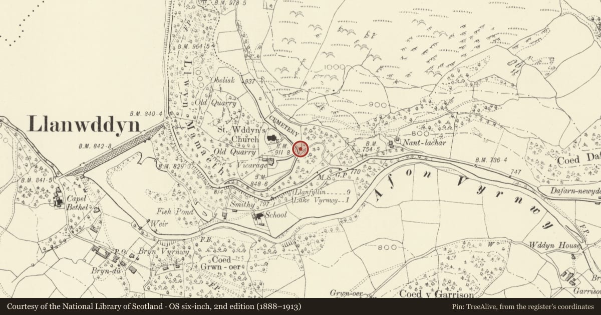
Slide toward Today to fade the historical sheet and see the modern map underneath.
David Rumsey Map Collection, Stanford LibrariesDavid Rumsey Map Collection, Stanford LibrariesLlyfrgell Genedlaethol Cymru – The National Library of WalesDavid Rumsey Map Collection, Stanford LibrariesDavid Rumsey Map Collection, Stanford Libraries
5 historical maps cover this location, the earliest the 1608 map "(13) Cambriae Typus." (David Rumsey Map Collection, Stanford Libraries).
Historical maps covering this location
- 1608 · (13) Cambriae Typus. (David Rumsey Map Collection, Stanford Libraries)
- 1795 · To Sir Watkin Williams-Wynn Bart ... the map of the six counties of North Wales is most… (Llyfrgell Genedlaethol Cymru – The National Library of Wales)
- 1883 · Watershed map England, Wales 3. (David Rumsey Map Collection, Stanford Libraries)
- 1899 · 136 Bala (Hills) (David Rumsey Map Collection, Stanford Libraries)
- 1901 · Sheet 9 and 10. (David Rumsey Map Collection, Stanford Libraries)
Cadw's description
Location
At the south end of the Cemetery beside St Wddyn's Parish Church, about 400 m east of lake Vyrnwy Dam.
History
St Wddyn's graveyard predates the closure of the original parish church and the construction of the present church (1887), and was probably established as a replacement when the flooding of the old church site was first anticipated in the 1860s, which is also the date of some of the earliest graves. This hearse house is probably an original feature of the graveyard.
Exterior
A building about 8 m by 6 m, in local slate masonry, the east side of which stands on the graveyard wall. Slate roof and tile ridge, coped gables. Double boarded doors in the south-facing front gable wall, with wrought-iron hinges and a timber lintel; boarded door at west side (facing graveyard) with a slate lintel. Cross-finial at front. High window at rear.
Reason for designation
A structure linked to the new churchyard of St Wddyn, probably the first structure related to the planning of the important Vyrnwy Reservoir.
Nearby in the register
- Parish Church of St WddynReligious, Ritual and Funeraryunder 1 mi
- Llanwddyn War MemorialCommemorativeunder 1 mi
- Workshops attached to nos. 3-6, Glanrafon, LlanwddynIndustrialunder 1 mi
- No. 6 Glanrafon, LlanwddynDomesticunder 1 mi
Other entries of the same register within about three miles of this one, by straight line.