Cof Cymru: National Historic Assets of Wales · Wales
Gelli
Moelfre, Isle of Anglesey, Wales
A Grade II listed building in Llanallgo, Moelfre, Isle of Anglesey, designated on 5 February 2003.
The record
- Designation
- Listed building, Grade II
- Broad class
- Agriculture and Subsistence
- Date of designation
- 5 February 2003
- Locality
- Llanallgo
- Community
- Moelfre
- Unitary authority
- Isle of Anglesey
- Country
- Wales
- Coordinates
- 53.34314, -4.24200
- Cadw reference
- 80867
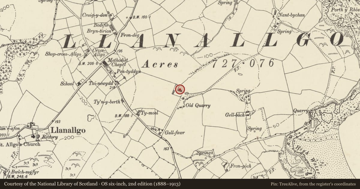
Slide toward Today to fade the historical sheet and see the modern map underneath.
David Rumsey Map Collection, Stanford LibrariesDavid Rumsey Map Collection, Stanford LibrariesDavid Rumsey Map Collection, Stanford LibrariesDavid Rumsey Map Collection, Stanford LibrariesDavid Rumsey Map Collection, Stanford Libraries
5 historical maps cover this location, the earliest the 1883 map "Watershed map England, Wales 3." (David Rumsey Map Collection, Stanford Libraries).
Historical maps covering this location
- 1883 · Watershed map England, Wales 3. (David Rumsey Map Collection, Stanford Libraries)
- 1896 · Sheet 7. Ordnance Survey of England and Wales. (David Rumsey Map Collection, Stanford Libraries)
- 1899 · 93 Holyhead (Hills) (David Rumsey Map Collection, Stanford Libraries)
- 1901 · Sheet 9 and 10. (David Rumsey Map Collection, Stanford Libraries)
- 1919 · Sheet 41. Anglesey. (David Rumsey Map Collection, Stanford Libraries)
Cadw's description
Location
A walled enclosure set well back from the NE side of the A5025 between the junctions to Marianglas and Llanallgo.
History
Early to mid C19 farmstead group. Not shown on the Tithe Map of the parish, 1847, though not all buildings are shown, particularly agricultural buildings; the land on which it stands is owned and occupied by Thomas Williams. By the time of the Census Returns for the parish, 1851, Ysgubor Gell is mentioned, occupied by Rowland Hughes, agricultural labourer and family.
Exterior
A square walled enclosure set into the corner of a field boundary. There are two buildings within the enclosure, both built of rubble masonry with hipped slate roofs. One is freestanding towards the E corner of the enclosure; the other is marked on the OS map as "limekiln" and is built into the W corner of the enclosure. One entrance is clearly visible in the SE wall; this leads out onto a disused limestone quarry.
Interior
Interior not inspected at the time of the survey.
Reason for designation
Included as a well preserved and complete farmstead/industrial unit which may represent an outlying estate development seemingly combining agricultural, domestic and small industrial buildings within the same complex. The plan and form of which is very unusual for Anglesey.
Nearby in the register
- Lime kilnIndustrialunder 1 mi
- Cottage at Fron HeulogDomesticunder 1 mi
- Bryn MoelDomesticunder 1 mi
- Tyn-y-llan including attached outbuilding rangeDomesticunder 1 mi
Other entries of the same register within about three miles of this one, by straight line.