Cof Cymru: National Historic Assets of Wales · Wales
Cottage at Fron Heulog
Llaneugrad, Isle of Anglesey, Wales
A Grade II listed building in Marianglas, Llaneugrad, Isle of Anglesey, designated on 2 May 2002.
The record
- Designation
- Listed building, Grade II
- Broad class
- Domestic
- Date of designation
- 2 May 2002
- Locality
- Marianglas
- Community
- Llaneugrad
- Unitary authority
- Isle of Anglesey
- Country
- Wales
- Coordinates
- 53.33775, -4.23840
- Cadw reference
- 26650
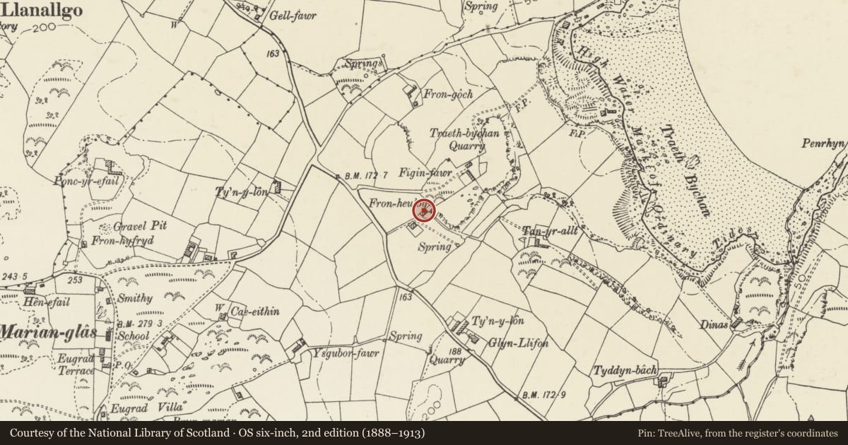
Slide toward Today to fade the historical sheet and see the modern map underneath.
David Rumsey Map Collection, Stanford LibrariesDavid Rumsey Map Collection, Stanford LibrariesDavid Rumsey Map Collection, Stanford LibrariesDavid Rumsey Map Collection, Stanford LibrariesDavid Rumsey Map Collection, Stanford Libraries
5 historical maps cover this location, the earliest the 1883 map "Watershed map England, Wales 3." (David Rumsey Map Collection, Stanford Libraries).
Historical maps covering this location
- 1883 · Watershed map England, Wales 3. (David Rumsey Map Collection, Stanford Libraries)
- 1896 · Sheet 7. Ordnance Survey of England and Wales. (David Rumsey Map Collection, Stanford Libraries)
- 1899 · 93 Holyhead (Hills) (David Rumsey Map Collection, Stanford Libraries)
- 1901 · Sheet 9 and 10. (David Rumsey Map Collection, Stanford Libraries)
- 1919 · Sheet 41. Anglesey. (David Rumsey Map Collection, Stanford Libraries)
Cadw's description
Location
Set back from the NE side of the A5025 just S of the junction with the B5110 to Marianglas; the cottage is located directly NE of the house at Fron Heulog.
History
Probably C19 farm labourers cottage. The Tithe Map of the parish of Llaneugrad shows no individual buildings and the cottage is not named in the Schedule or in the Census Returns of 1841 and 1851. It is likely that the cottage was a labourers cottage for the workers at the adjacent farm at Figin Bach, owned by Lord Dinorben and farmed by John Owen.
Exterior
Single storey cottage, built of rubble masonry, limewashed. Grouted slate roof, gable stacks with capping. The entrance elevation opens into a small yard to SE; central doorway with flanking 4-pane sash windows. There is a single small window to the rear and 2 iron-framed skylights. A modern flat roofed extension has been built to the L (SW) and a raised seating area to the R.
Interior
Interior not viewed at the time of the inspection (September 2001).
Reason for designation
Included, notwithstanding additions, as a good C19 labourers cottage which retains its original simple plan and vernacular character.
Nearby in the register
- Lime kilnIndustrialunder 1 mi
- Bryn MoelDomesticunder 1 mi
- Lime kilnIndustrialunder 1 mi
- HendyDomesticunder 1 mi
Other entries of the same register within about three miles of this one, by straight line.