Cof Cymru: National Historic Assets of Wales · Wales
Outside kitchen at Glyn Bran Farm
Upper Cwmbran, Torfaen, Wales
A Grade II listed building in Upper Cwmbran, Cwmbran, Torfaen, designated on 17 November 1987.
The record
- Designation
- Listed building, Grade II
- Broad class
- No class recorded
- Date of designation
- 17 November 1987
- Locality
- Upper Cwmbran
- Town
- Cwmbran
- Community
- Upper Cwmbran
- Unitary authority
- Torfaen
- Country
- Wales
- Coordinates
- 51.66707, -3.05129
- Cadw reference
- 80860
Slide toward Today to fade the historical sheet and see the modern map underneath.
David Rumsey Map Collection, Stanford LibrariesDavid Rumsey Map Collection, Stanford LibrariesDavid Rumsey Map Collection, Stanford LibrariesDavid Rumsey Map Collection, Stanford LibrariesDavid Rumsey Map Collection, Stanford Libraries
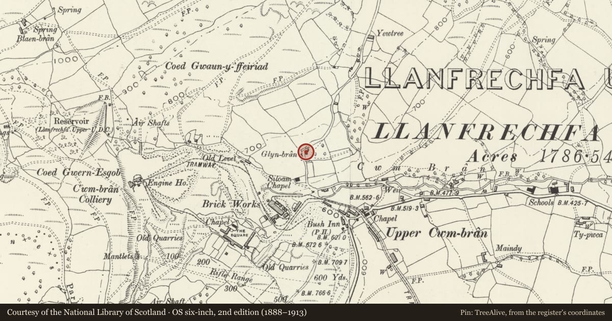
5 historical maps cover this location, the earliest the 1636 map "Cornubia : Devonia, Somersetus, Dorcestria, Wiltonia, Glocestria ..." (David Rumsey Map Collection, Stanford Libraries).
Historical maps covering this location
- 1636 · Cornubia : Devonia, Somersetus, Dorcestria, Wiltonia, Glocestria ... (David Rumsey Map Collection, Stanford Libraries)
- 1830 · V.3:11-15:XV.Britisches Reich. A. Kon: England. a. England ab sich: Shire:15-17, 33 (David Rumsey Map Collection, Stanford Libraries)
- 1895 · Sheet 11. Ordnance Survey of England and Wales. (David Rumsey Map Collection, Stanford Libraries)
- 1906 · 249 Newport (Hills) (David Rumsey Map Collection, Stanford Libraries)
- 1913 · Sheet 102. Newport. (David Rumsey Map Collection, Stanford Libraries)
Cadw's description
Location
Situated just N of Glyn Bran Farmhouse.
History
Small C17 or early C18 detached outbuilding, presumably an outside kitchen.
Exterior
Outbuilding, former outside kitchen, rubble stone with slate roof and stone right gable end chimney with weathercoursing. Side wall has very large rubble buttress against left side and window to right with lintel and stonework above lost. Left gable end is altered in late C19 or earlier C20, gable open with yellow brick in angles, ground floor is stone with doorway to right, the right jamb narrowed in yellow brick. Right end wall has large external chimneybreast with 3 offsets: 2 square steps and one chamfered. Window blocked in brick to left.
Interior
Beams of loft floor. One tie-beam and collar pegged truss. Blocked fireplace with timber lintel, recess to left in corner.
Reason for designation
Included as a surviving example of the small outside kitchens once typical of regional farmhouses.
Nearby in the register
- Barn at Glyn Bran FarmNo class recordedunder 1 mi
- Glyn Bran FarmhouseDomesticunder 1 mi
- Capel-llwydDomesticunder 1 mi
- Barn at Capel-llwydNo class recordedunder 1 mi
Other entries of the same register within about three miles of this one, by straight line.