Cof Cymru: National Historic Assets of Wales · Wales
Barn at Capel-llwyd
Upper Cwmbran, Torfaen, Wales
A Grade II listed building in Mountain Road, Cwmbran, Upper Cwmbran, Torfaen, designated on 30 January 2003.
The record
- Designation
- Listed building, Grade II
- Broad class
- No class recorded
- Date of designation
- 30 January 2003
- Locality
- Mountain Road
- Town
- Cwmbran
- Community
- Upper Cwmbran
- Unitary authority
- Torfaen
- Country
- Wales
- Coordinates
- 51.67634, -3.04528
- Cadw reference
- 80858
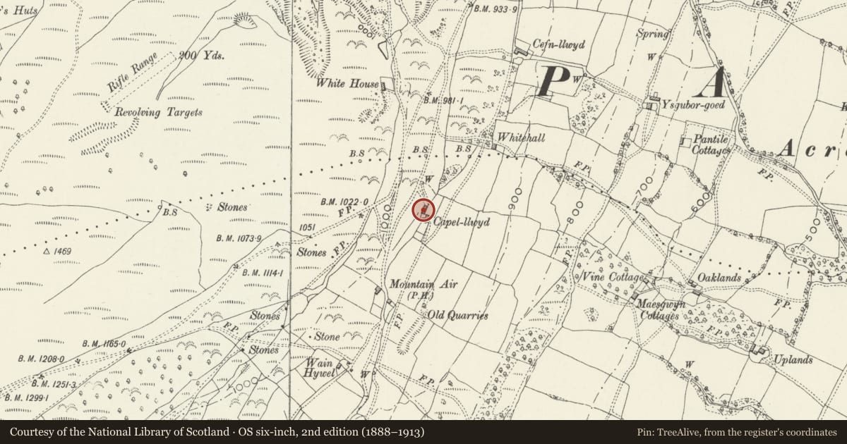
Slide toward Today to fade the historical sheet and see the modern map underneath.
David Rumsey Map Collection, Stanford LibrariesDavid Rumsey Map Collection, Stanford LibrariesDavid Rumsey Map Collection, Stanford LibrariesDavid Rumsey Map Collection, Stanford LibrariesDavid Rumsey Map Collection, Stanford Libraries
5 historical maps cover this location, the earliest the 1636 map "Cornubia : Devonia, Somersetus, Dorcestria, Wiltonia, Glocestria ..." (David Rumsey Map Collection, Stanford Libraries).
Historical maps covering this location
- 1636 · Cornubia : Devonia, Somersetus, Dorcestria, Wiltonia, Glocestria ... (David Rumsey Map Collection, Stanford Libraries)
- 1830 · V.3:11-15:XV.Britisches Reich. A. Kon: England. a. England ab sich: Shire:15-17, 33 (David Rumsey Map Collection, Stanford Libraries)
- 1895 · Sheet 11. Ordnance Survey of England and Wales. (David Rumsey Map Collection, Stanford Libraries)
- 1906 · 249 Newport (Hills) (David Rumsey Map Collection, Stanford Libraries)
- 1913 · Sheet 102. Newport. (David Rumsey Map Collection, Stanford Libraries)
Cadw's description
Location
Situated just to the NW of the house at Capel-llwyd.
History
Outbuilding, probably earlier C19, with barn and lofted stables under single roof.
Exterior
Barn, squared rubble stone with asbestos sheet roof. Barn entry to right is relatively low with stone voussoirs to cambered-headed opening, C20 sliding doors. Small vent loop each side. To left is cambered-headed door with stone voussoirs and a third vent loop. Stable to left has door with taller head and stone voussoirs, and a small window. Left end has raised string course under gable and added brick single-storey building. Windowless right end wall with triangular apex vent. Rear wall has blocked barn door with stone voussoirs to left, vent loop each side and small window right.
Interior
Stable has 3 loft beams. Barn left side is lofted on 4 beams. Stone-flagged centre threshing floor. Five-bay roof of 4 tie-beam trusses, much repaired with added collars.
Reason for designation
Included as a large stone barn of group value with the house.
Nearby in the register
- Capel-llwydDomesticunder 1 mi
- Iron Ore Scours at Upper Race, PontypoolIron mineunder 1 mi
- Ty William Ambrose Farm (aka Hanbury Farm)Agriculture and Subsistenceunder 1 mi
- Outside kitchen at Glyn Bran FarmNo class recordedunder 1 mi
Other entries of the same register within about three miles of this one, by straight line.