Cof Cymru: National Historic Assets of Wales · Wales
Is-y-bryn
Montgomery, Powys, Wales
A Grade II listed building in Montgomery, Powys, designated on 30 March 1983.
The record
- Designation
- Listed building, Grade II
- Broad class
- Domestic
- Date of designation
- 30 March 1983
- Town
- Montgomery
- Community
- Montgomery
- Unitary authority
- Powys
- Country
- Wales
- Coordinates
- 52.56046, -3.14772
- Cadw reference
- 7936
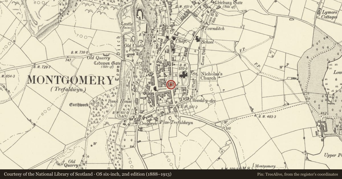
Slide toward Today to fade the historical sheet and see the modern map underneath.
David Rumsey Map Collection, Stanford LibrariesDavid Rumsey Map Collection, Stanford LibrariesDavid Rumsey Map Collection, Stanford LibrariesLlyfrgell Genedlaethol Cymru – The National Library of WalesDavid Rumsey Map Collection, Stanford Libraries
5 historical maps cover this location, the earliest the 1637 map "Particular description of Wales. Cambria seu Wallia" (David Rumsey Map Collection, Stanford Libraries).
Historical maps covering this location
- 1637 · Particular description of Wales. Cambria seu Wallia (David Rumsey Map Collection, Stanford Libraries)
- 1795 · To Sir Watkin Williams-Wynn Bart ... the map of the six counties of North Wales is most… (Llyfrgell Genedlaethol Cymru – The National Library of Wales)
- 1883 · Watershed map England, Wales 3. (David Rumsey Map Collection, Stanford Libraries)
- 1899 · 165 Montgomery (Hills) (David Rumsey Map Collection, Stanford Libraries)
- 1901 · Sheet 14. (David Rumsey Map Collection, Stanford Libraries)
Cadw's description
Location
Situated in terraced row, the right half of a mirrored pair with Cotswold to right.
History
One of a pair of houses refronted in red brick in early C19 but probably of C17 origins as there are substantial timbers in Cotswold adjoining. Marked on 1833 map as owned by the Powis estate, occupied in 1839 by John Davies.
Exterior
One half of a cottage pair with red brick front, laid in Flemish bond, dentilled eaves and slate roof with large red brick stack between the houses. Two storeys, each of one window bay and outer door cornice. Windows with brick voussoirs and stone sills are a C20 metal triple casement to first floor, above a horned square large 8-paned sash. Outer door is framed and ledged with thin cover strips, in doorcase of thin reeded pilasters, fascia and cornice.
Plastered rear elevations with single storey outshuts.
Stone setts to front.
Interior
Interior not inspected.
Reason for designation
Included as a pair of small houses with red brick Georgian exterior caharacter and possible timber-framed origins.
Nearby in the register
- CotswoldDomesticunder 1 mi
- The Checkers HotelCommercialunder 1 mi
- Milestone at corner of Princes Street and Church BankTransportunder 1 mi
- Pump at corner of Church BankWater Supply and Drainageunder 1 mi
Other entries of the same register within about three miles of this one, by straight line.