Cof Cymru: National Historic Assets of Wales · Wales
1 Boot Street
Welshpool, Powys, Wales
A Grade II listed building in Welshpool, Powys, designated on 11 March 1981.
The record
- Designation
- Listed building, Grade II
- Broad class
- Domestic
- Date of designation
- 11 March 1981
- Locality
- Welshpool
- Community
- Welshpool
- Unitary authority
- Powys
- Country
- Wales
- Coordinates
- 52.66046, -3.14824
- Cadw reference
- 7761
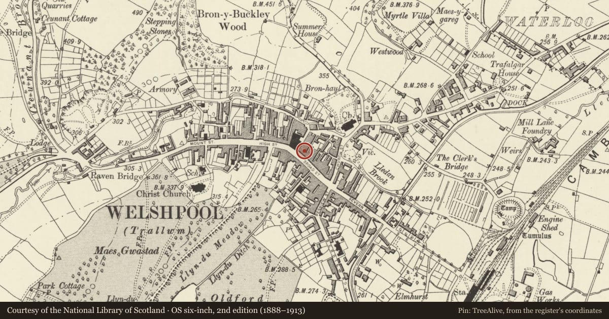
Slide toward Today to fade the historical sheet and see the modern map underneath.
David Rumsey Map Collection, Stanford LibrariesDavid Rumsey Map Collection, Stanford LibrariesDavid Rumsey Map Collection, Stanford LibrariesDavid Rumsey Map Collection, Stanford LibrariesLlyfrgell Genedlaethol Cymru – The National Library of Wales
5 historical maps cover this location, the earliest the 1795 map "To Sir Watkin Williams-Wynn Bart ... the map of the six counties of North Wales is most humbly inscribed by his obedient humble servant" (Llyfrgell Genedlaethol Cymru – The National Library of Wales).
Historical maps covering this location
- 1795 · To Sir Watkin Williams-Wynn Bart ... the map of the six counties of North Wales is most… (Llyfrgell Genedlaethol Cymru – The National Library of Wales)
- 1883 · Watershed map England, Wales 3. (David Rumsey Map Collection, Stanford Libraries)
- 1899 · 151 Welshpool (Hills) (David Rumsey Map Collection, Stanford Libraries)
- 1901 · Sheet 9 and 10. (David Rumsey Map Collection, Stanford Libraries)
- 1916 · Sheet 60. Shrewsbury. (David Rumsey Map Collection, Stanford Libraries)
Cadw's description
Location
At the rear of No 4 Broad Street
History
Built as a house, probably in the late C18, though incorporating an earlier building on the site (the roof-line has clearly been raised from an earlier profile visible in the gable end). The building now forms part of the adjacent frontage property.
Exterior
Painted brick with slate roof. Truncated stack on left hand gable end. 2 storeys, 2-window range, with central entrance. Doorway (the 6-panelled door now boarded over) with slight canopy hood flanked by blocked windows with single-ring cambered brick heads. Upper windows are iron casements with small panes in pegged wood frames with cambered brick heads. Wrought-iron quadrant stay survives to left hand upper window.
Reason for designation
The building represents a virtually complete surviving example of a late C18 urban cottage, of particular interest as a formerly independent dwelling built as infil on a burgage plot.
Nearby in the register
- 4 Broad StreetDomesticunder 1 mi
- 3 Broad StreetDomesticunder 1 mi
- 5 Broad StreetDomesticunder 1 mi
- Pinewood TavernCommercialunder 1 mi
Other entries of the same register within about three miles of this one, by straight line.