Cof Cymru: National Historic Assets of Wales · Wales
Pinewood Tavern
Welshpool, Powys, Wales
A Grade II listed building in Welshpool, Powys, designated on 11 March 1981.
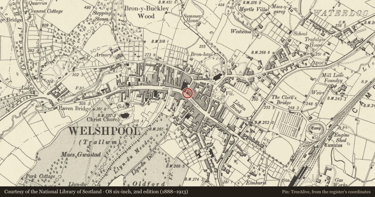
The record
- Designation
- Listed building, Grade II
- Broad class
- Commercial
- Date of designation
- 11 March 1981
- Locality
- Welshpool
- Community
- Welshpool
- Unitary authority
- Powys
- Country
- Wales
- Coordinates
- 52.66044, -3.14845
- Cadw reference
- 16607
Slide toward Today to fade the historical sheet and see the modern map underneath.
David Rumsey Map Collection, Stanford LibrariesDavid Rumsey Map Collection, Stanford LibrariesDavid Rumsey Map Collection, Stanford LibrariesDavid Rumsey Map Collection, Stanford LibrariesLlyfrgell Genedlaethol Cymru – The National Library of Wales
5 historical maps cover this location, the earliest the 1795 map "To Sir Watkin Williams-Wynn Bart ... the map of the six counties of North Wales is most humbly inscribed by his obedient humble servant" (Llyfrgell Genedlaethol Cymru – The National Library of Wales).
Historical maps covering this location
- 1795 · To Sir Watkin Williams-Wynn Bart ... the map of the six counties of North Wales is most… (Llyfrgell Genedlaethol Cymru – The National Library of Wales)
- 1883 · Watershed map England, Wales 3. (David Rumsey Map Collection, Stanford Libraries)
- 1899 · 151 Welshpool (Hills) (David Rumsey Map Collection, Stanford Libraries)
- 1901 · Sheet 9 and 10. (David Rumsey Map Collection, Stanford Libraries)
- 1916 · Sheet 60. Shrewsbury. (David Rumsey Map Collection, Stanford Libraries)
Cadw's description
History
Nos 1-2 Broad Street form a single building probably built c1800 on land that had previously been an open courtyard in front of the market hall which was demolished in 1761. Previously (and perhaps originally) The Boars Head Public House
Exterior
Painted brick with slate roof, hipped on corner with Hall Street; gable end stack to right. 3 storeys, 3-window range. Ground floor entirely renewed with C20 public house frontage, but 16-pane sash windows with flat arched gauged brick heads survive on the upper floors. Canted bay window (a later C19 insertion) to the right of the first floor, with lower 8-pane sash window above it. Nogged eaves band. Long full-height rear wing to No 2, with mono-pitched roof.
Reason for designation
Part of a group of late C18-early C19 commercial properties in the town centre, and having group value with the town hall.
Nearby in the register
- 3 Broad StreetDomesticunder 1 mi
- Pinewood TavernCommercialunder 1 mi
- 4 Broad StreetDomesticunder 1 mi
- Pinewood TavernCommercialunder 1 mi
Other entries of the same register within about three miles of this one, by straight line.