Cof Cymru: National Historic Assets of Wales · Wales
Lychgate at St Cynfarch and St Mary's Church
Llanfair Dyffryn Clwyd, Denbighshire, Wales
A Grade II listed building in Llanfair Dyffryn Clwyd, Denbighshire, designated on 19 July 1966.
The record
- Designation
- Listed building, Grade II
- Broad class
- Religious, Ritual and Funerary
- Date of designation
- 19 July 1966
- Locality
- Llanfair Dyffryn Clwyd
- Community
- Llanfair Dyffryn Clwyd
- Unitary authority
- Denbighshire
- Country
- Wales
- Coordinates
- 53.08918, -3.29373
- Cadw reference
- 769
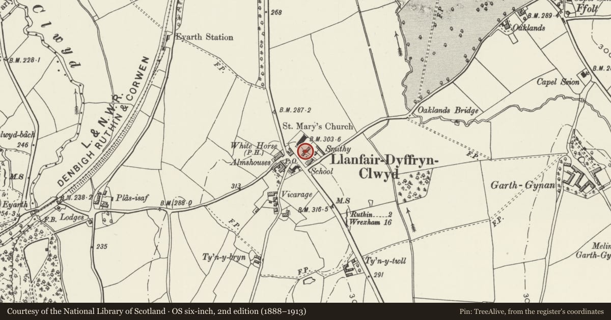
Slide toward Today to fade the historical sheet and see the modern map underneath.
David Rumsey Map Collection, Stanford LibrariesDavid Rumsey Map Collection, Stanford LibrariesLlyfrgell Genedlaethol Cymru – The National Library of WalesDavid Rumsey Map Collection, Stanford LibrariesDavid Rumsey Map Collection, Stanford Libraries
5 historical maps cover this location, the earliest the 1795 map "To Sir Watkin Williams-Wynn Bart ... the map of the six counties of North Wales is most humbly inscribed by his obedient humble servant" (Llyfrgell Genedlaethol Cymru – The National Library of Wales).
Historical maps covering this location
- 1795 · To Sir Watkin Williams-Wynn Bart ... the map of the six counties of North Wales is most… (Llyfrgell Genedlaethol Cymru – The National Library of Wales)
- 1830 · V.3:11-15:XV. Britisches Reich. A. Kon: England. b. Frstenthum Wales: Shire: 37-40 (David Rumsey Map Collection, Stanford Libraries)
- 1883 · Watershed map England, Wales 3. (David Rumsey Map Collection, Stanford Libraries)
- 1898 · 121 Wrexham (Hills) (David Rumsey Map Collection, Stanford Libraries)
- 1901 · Sheet 9 and 10. (David Rumsey Map Collection, Stanford Libraries)
Cadw's description
Location
At the south entrance to St Cynfarch and St Mary's churchyard.
History
Built in 1708, restored in 1938.
Exterior
A lightly-built timber-framed lychgate with slate roof and low plinth walls each side in stone. The structure carries the date 1708 on each face. To the north is the wording 'Heb Dduw, heb ddim' and to the south the initials EP, IR, IP and IE.
The tie beams at front and rear are supported on arched braces, giving a four-centred soffit to each. Above are curved struts. The sides are two panels high by six in length, the upper panels with vertical timber bars.
Reason for designation
Listed as a late example of a timber framed lychgate, and for group value with the Church of St Cynfarch and St Mary.
Nearby in the register
- Church HouseReligious, Ritual and Funeraryunder 1 mi
- Preaching Cross in Churchyard of Church of St Cynfarch and St MaryReligious, Ritual and Funeraryunder 1 mi
- Church of St Cynfarch and St MaryReligious, Ritual and Funeraryunder 1 mi
- Ceffyl Gwyn Public HouseCommercialunder 1 mi
Other entries of the same register within about three miles of this one, by straight line.