Cof Cymru: National Historic Assets of Wales · Wales
Preaching Cross in Churchyard of Church of St Cynfarch and St Mary
Llanfair Dyffryn Clwyd, Denbighshire, Wales
A Grade II listed building in Llanfair Dyffryn Clwyd, Denbighshire, designated on 19 May 2001.
The record
- Designation
- Listed building, Grade II
- Broad class
- Religious, Ritual and Funerary
- Date of designation
- 19 May 2001
- Locality
- Llanfair Dyffryn Clwyd
- Community
- Llanfair Dyffryn Clwyd
- Unitary authority
- Denbighshire
- Country
- Wales
- Coordinates
- 53.08937, -3.29366
- Cadw reference
- 25208
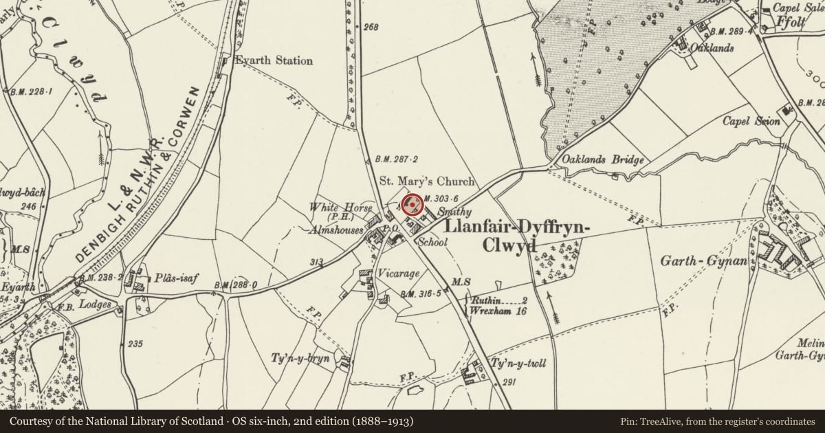
Slide toward Today to fade the historical sheet and see the modern map underneath.
David Rumsey Map Collection, Stanford LibrariesDavid Rumsey Map Collection, Stanford LibrariesLlyfrgell Genedlaethol Cymru – The National Library of WalesDavid Rumsey Map Collection, Stanford LibrariesDavid Rumsey Map Collection, Stanford Libraries
5 historical maps cover this location, the earliest the 1795 map "To Sir Watkin Williams-Wynn Bart ... the map of the six counties of North Wales is most humbly inscribed by his obedient humble servant" (Llyfrgell Genedlaethol Cymru – The National Library of Wales).
Historical maps covering this location
- 1795 · To Sir Watkin Williams-Wynn Bart ... the map of the six counties of North Wales is most… (Llyfrgell Genedlaethol Cymru – The National Library of Wales)
- 1830 · V.3:11-15:XV. Britisches Reich. A. Kon: England. b. Frstenthum Wales: Shire: 37-40 (David Rumsey Map Collection, Stanford Libraries)
- 1883 · Watershed map England, Wales 3. (David Rumsey Map Collection, Stanford Libraries)
- 1898 · 121 Wrexham (Hills) (David Rumsey Map Collection, Stanford Libraries)
- 1901 · Sheet 9 and 10. (David Rumsey Map Collection, Stanford Libraries)
Cadw's description
Location
In St Cynfarch and St Mary's churchyard, south of the church porch.
History
A C15 preaching cross, converted in c1800 to a churchyard sundial.
Exterior
Of the preaching cross only the calvary and the bottom half metre of the shaft has survived: the shaft is let into a base block standing on two stone steps. On the reduced shaft a bronze sundial has been fixed. It is marked E[dward] Tavo, fecit, Chester (Tavo was an instrument maked in Eastgate Street). The date 1800 is carved into the stone at one side.
Reason for designation
Listed for group value with the Church of St Cynfarch and St Mary.
Nearby in the register
- Church of St Cynfarch and St MaryReligious, Ritual and Funeraryunder 1 mi
- Church HouseReligious, Ritual and Funeraryunder 1 mi
- Lychgate at St Cynfarch and St Mary's ChurchReligious, Ritual and Funeraryunder 1 mi
- Ceffyl Gwyn Public HouseCommercialunder 1 mi
Other entries of the same register within about three miles of this one, by straight line.