Cof Cymru: National Historic Assets of Wales · Wales
Glascoed
Meifod, Powys, Wales
A Grade II listed building in Newbridge, Meifod, Powys, designated on 31 January 1953.
The record
- Designation
- Listed building, Grade II
- Broad class
- Domestic
- Date of designation
- 31 January 1953
- Locality
- Newbridge
- Community
- Meifod
- Unitary authority
- Powys
- Country
- Wales
- Coordinates
- 52.70163, -3.27003
- Cadw reference
- 7651
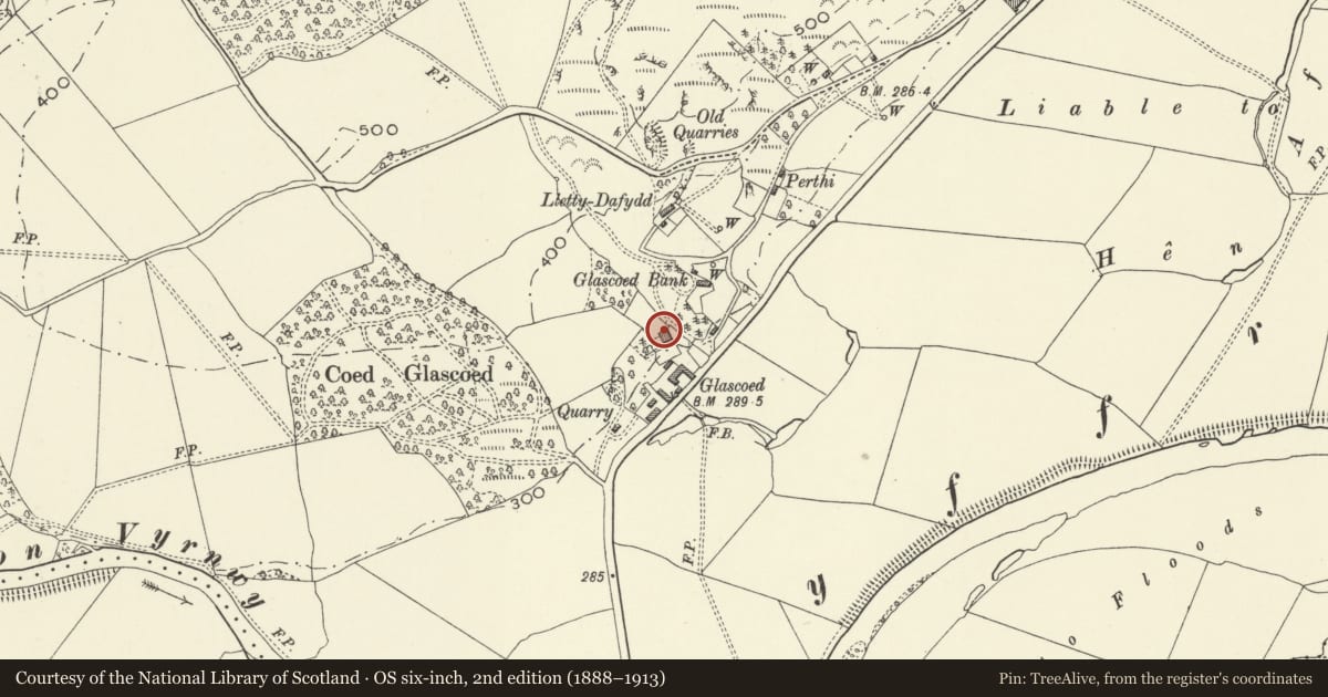
Slide toward Today to fade the historical sheet and see the modern map underneath.
David Rumsey Map Collection, Stanford LibrariesDavid Rumsey Map Collection, Stanford LibrariesDavid Rumsey Map Collection, Stanford LibrariesLlyfrgell Genedlaethol Cymru – The National Library of WalesDavid Rumsey Map Collection, Stanford Libraries
5 historical maps cover this location, the earliest the 1795 map "To Sir Watkin Williams-Wynn Bart ... the map of the six counties of North Wales is most humbly inscribed by his obedient humble servant" (Llyfrgell Genedlaethol Cymru – The National Library of Wales).
Historical maps covering this location
- 1795 · To Sir Watkin Williams-Wynn Bart ... the map of the six counties of North Wales is most… (Llyfrgell Genedlaethol Cymru – The National Library of Wales)
- 1883 · Watershed map England, Wales 3. (David Rumsey Map Collection, Stanford Libraries)
- 1899 · 151 Welshpool (Hills) (David Rumsey Map Collection, Stanford Libraries)
- 1901 · Sheet 9 and 10. (David Rumsey Map Collection, Stanford Libraries)
- 1916 · Sheet 60. Shrewsbury. (David Rumsey Map Collection, Stanford Libraries)
Cadw's description
Location
Located back from the road, behind its farm buildings, on a platform site at right angles to the slope of the hill.
History
The property was at various times owned by the Vaughan and later the Rocke families.
Exterior
Farmhouse of the early C17, timber framed with whitewashed walls and slate roof. 'T'-plan consisting of a two-bay main range with entrance lobby against the west gable stack, and a one-bay rear block.
Timber framing close studded with mid-wall bressumer. Four-panelled boarded door in W bay, and gabled hood. Two light windows with overlights, the windows having moulded architraves. Bracketed E gable, with decorative raking struts to queen posts, and 2 tiers of purlins. W gable end of stone, with the main stack, and a large external stack with 4 offsets, capped in brick, to the E gable.
Interior
Lobby entry to main living room which has ceiling divided by chamfered cross beams into 6 compartments, the rear bays now divided off. Panelled door against front wall to inner room at E end.
Reason for designation
Listed as a well-preserved house of the early C17.
Nearby in the register
- Pig Sties at Glascoed MillAgriculture and Subsistenceunder 1 mi
- Glascoed MillIndustrialunder 1 mi
- Cowhouse and Granary on W side of Farmyard at Dyffryn FarmAgriculture and Subsistenceunder 1 mi
- Cowhouse forming N side of Farmyard at Dyffryn FarmAgriculture and Subsistenceunder 1 mi
Other entries of the same register within about three miles of this one, by straight line.