Cof Cymru: National Historic Assets of Wales · Wales
Black Hall
Kerry, Powys, Wales
A Grade II listed building in Pentre, Newtown, Kerry, Powys, designated on 10 March 1953.
The record
- Designation
- Listed building, Grade II
- Broad class
- Domestic
- Date of designation
- 10 March 1953
- Locality
- Pentre
- Town
- Newtown
- Community
- Kerry
- Unitary authority
- Powys
- Country
- Wales
- Coordinates
- 52.49006, -3.24606
- Cadw reference
- 7563
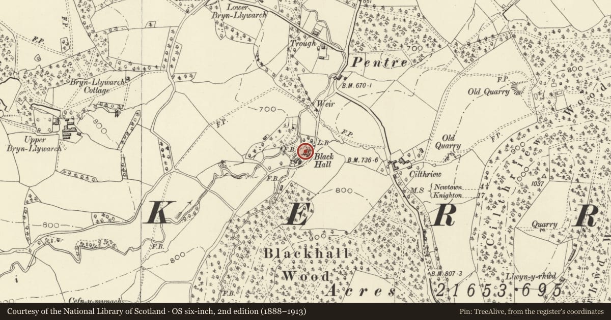
Slide toward Today to fade the historical sheet and see the modern map underneath.
David Rumsey Map Collection, Stanford LibrariesDavid Rumsey Map Collection, Stanford LibrariesDavid Rumsey Map Collection, Stanford LibrariesDavid Rumsey Map Collection, Stanford LibrariesDavid Rumsey Map Collection, Stanford Libraries
5 historical maps cover this location, the earliest the 1608 map "(13) Cambriae Typus." (David Rumsey Map Collection, Stanford Libraries).
Historical maps covering this location
- 1608 · (13) Cambriae Typus. (David Rumsey Map Collection, Stanford Libraries)
- 1637 · Particular description of Wales. Cambria seu Wallia (David Rumsey Map Collection, Stanford Libraries)
- 1883 · Watershed map England, Wales 3. (David Rumsey Map Collection, Stanford Libraries)
- 1899 · 165 Montgomery (Hills) (David Rumsey Map Collection, Stanford Libraries)
- 1901 · Sheet 14. (David Rumsey Map Collection, Stanford Libraries)
Cadw's description
Location
Located beside the road climbing the valley to Cefn-y-mynach and the Kerry ridge.
History
Gentry house of the late C18, remodelled in the early mid-C19. It was the home of Richard Jones, 1788, purser to the Royal Navy and philanthropist, and later of John Wilkes Poundley (1807-1872), the surveyor for Montgomeryshire from 1861. The road originally ran NW of the house, but was re-aligned after 1842 around the SE side to permit the laying out of the gardens.
Exterior
Brick, laid in lime putty to Flemish bond, with slate roofs. The main range extend NE to SW with rear wings at the centre and at NE end extending to a later parallel range, and forming a reentrant garden on the SW leading to the service yard. Two storeys and cellars, the main range 5 bays long, symmetrical, the centre bay set forward, and having an added porch, mid-later C19, with a central 6-panelled door flanked by paired brick pilasters, stone cornice and stone ball finials raised on blocks. The upper window is round headed. The two bays either side have C19 4-pane windows in openings with rubbed flat brick arches. Boxed eaves. Brick stack central and external to each gable end. The E gable end is painted, with a tripartite door under a 3-centred brick arch with keystone.
Interior
Not accessible at time of inspection (February 1996).
Reason for designation
Included as a well preserved gentry house, finely detailed and proportioned in a simplified Neo-Classical style.
Nearby in the register
- Farm building at Cilthriew FarmAgriculture and Subsistenceunder 1 mi
- CilthriewDomesticunder 1 mi
- Outbuilding at CilthriewAgriculture and Subsistenceunder 1 mi
- Mile marker at CilthriewTransportunder 1 mi
Other entries of the same register within about three miles of this one, by straight line.