Cof Cymru: National Historic Assets of Wales · Wales
Farm building at Cilthriew Farm
Kerry, Powys, Wales
A Grade II listed building in Pentre, Newtown, Kerry, Powys, designated on 12 September 1996.
The record
- Designation
- Listed building, Grade II
- Broad class
- Agriculture and Subsistence
- Date of designation
- 12 September 1996
- Locality
- Pentre
- Town
- Newtown
- Community
- Kerry
- Unitary authority
- Powys
- Country
- Wales
- Coordinates
- 52.48968, -3.24233
- Cadw reference
- 17307
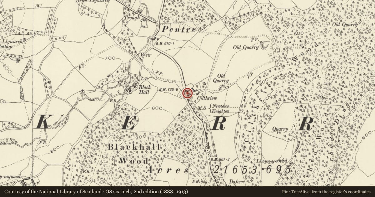
Slide toward Today to fade the historical sheet and see the modern map underneath.
David Rumsey Map Collection, Stanford LibrariesDavid Rumsey Map Collection, Stanford LibrariesDavid Rumsey Map Collection, Stanford LibrariesDavid Rumsey Map Collection, Stanford LibrariesDavid Rumsey Map Collection, Stanford Libraries
5 historical maps cover this location, the earliest the 1608 map "(13) Cambriae Typus." (David Rumsey Map Collection, Stanford Libraries).
Historical maps covering this location
- 1608 · (13) Cambriae Typus. (David Rumsey Map Collection, Stanford Libraries)
- 1637 · Particular description of Wales. Cambria seu Wallia (David Rumsey Map Collection, Stanford Libraries)
- 1883 · Watershed map England, Wales 3. (David Rumsey Map Collection, Stanford Libraries)
- 1899 · 165 Montgomery (Hills) (David Rumsey Map Collection, Stanford Libraries)
- 1901 · Sheet 14. (David Rumsey Map Collection, Stanford Libraries)
Cadw's description
Location
Located on the E side of the road from Kerry to The Anchor backing on to the road and facing the farmhouse.
Exterior
Farm building. Mid C19 to replace an earlier range shown on the 1842 Tithe Map. Brickwork with slate roof. Forms 3 sides of a yard, with central single-storey block with two-storey hip-roofed end wings, the SE flanking the entrance to the farmyard. The central block has three stable door openings with timber doors to the yard, with two openings to the inner face of each wing, the inner recessed. Small ventilation slits to the road elevation, but pitching door to the NW wing. Timber stair to first floor door at the inner end of the SE wing. Later lean-to against gable of N wing, its wall continuing to meet the gable end of the house.
Reason for designation
Included as a well preserved range of farm buildings, of group value with the listed Cilthriew farmhouse and outbuilding to SE.
Nearby in the register
- CilthriewDomesticunder 1 mi
- Outbuilding at CilthriewAgriculture and Subsistenceunder 1 mi
- Mile marker at CilthriewTransportunder 1 mi
- Black HallDomesticunder 1 mi
Other entries of the same register within about three miles of this one, by straight line.