Cof Cymru: National Historic Assets of Wales · Wales
The Old House
Llanfihangel Cwmdu with Bwlch and Cathedine, Powys, Wales
A Grade II listed building in Felindre, Llanfihangel Cwmdu with Bwlch and Cathedine, Powys, designated on 9 May 1989.
The record
- Designation
- Listed building, Grade II
- Broad class
- Domestic
- Date of designation
- 9 May 1989
- Locality
- Felindre
- Community
- Llanfihangel Cwmdu with Bwlch and Cathedine
- Unitary authority
- Powys
- Country
- Wales
- Coordinates
- 51.90202, -3.19588
- Cadw reference
- 7498
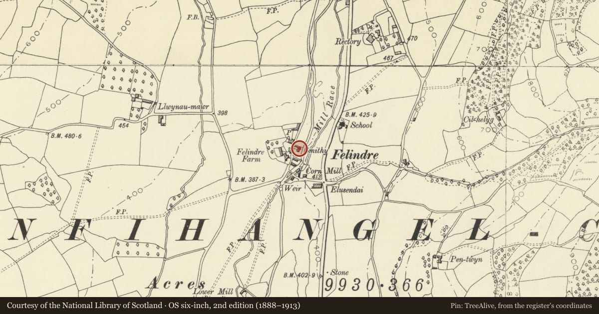
Slide toward Today to fade the historical sheet and see the modern map underneath.
David Rumsey Map Collection, Stanford LibrariesDavid Rumsey Map Collection, Stanford LibrariesDavid Rumsey Map Collection, Stanford LibrariesDavid Rumsey Map Collection, Stanford LibrariesDavid Rumsey Map Collection, Stanford Libraries
5 historical maps cover this location, the earliest the 1636 map "Cornubia : Devonia, Somersetus, Dorcestria, Wiltonia, Glocestria ..." (David Rumsey Map Collection, Stanford Libraries).
Historical maps covering this location
- 1636 · Cornubia : Devonia, Somersetus, Dorcestria, Wiltonia, Glocestria ... (David Rumsey Map Collection, Stanford Libraries)
- 1856 · 42. Brecon. (David Rumsey Map Collection, Stanford Libraries)
- 1895 · Sheet 11. Ordnance Survey of England and Wales. (David Rumsey Map Collection, Stanford Libraries)
- 1896 · 214 Talgarth (Hills) (David Rumsey Map Collection, Stanford Libraries)
- 1901 · Sheet 14. (David Rumsey Map Collection, Stanford Libraries)
Cadw's description
Location
Set back from E side of minor road through Felindre. Restored late C20.
History
A sub-medieval house, cruck-framed hall house (possibly C16) with a later smithy attached.
Exterior
Two-storey cottage of rubble stone with steeply pitched, renewed slate roof (formerly stone tile) and end stone stacks. Doorway L of centre has a timber lintel and a boarded and ribbed door. Inserted casement window to L and renewed casement R of doorway in earlier opening. First-floor beam ends exposed in front wall. In the upper storey is a window offset to R beneath the wall plate with restored diamond mullions. Smithy is 1-storey L-plan range forward on L side, with inserted openings all late C20.
Interior
Not inspected at time of survey (September 1997), but said to contain flagged through passage flanked by two post-and-panel partitions with Tudor-arched door frames; S gable said to retain open chimney breast with chamfered lintel and turning stone stair to its L. Chamfered but not stopped beams inserted in C17 conversion. Cruck-blades have been recorded visible at first floor level.
Reason for designation
Good example of a regional building type retaining early plan form.
Nearby in the register
- Barn at CartrefAgriculture and Subsistenceunder 1 mi
- Felindre FarmhouseDomesticunder 1 mi
- Bridge at FelindreTransportunder 1 mi
- The Old RectoryDomesticunder 1 mi
Other entries of the same register within about three miles of this one, by straight line.