Cof Cymru: National Historic Assets of Wales · Wales
Rock House
Hay, Powys, Wales
A Grade II listed building in Hay-on-Wye, Hay, Powys, designated on 1 February 1988.
The record
- Designation
- Listed building, Grade II
- Broad class
- Domestic
- Date of designation
- 1 February 1988
- Town
- Hay-on-Wye
- Community
- Hay
- Unitary authority
- Powys
- Country
- Wales
- Coordinates
- 52.07682, -3.12516
- Cadw reference
- 7398
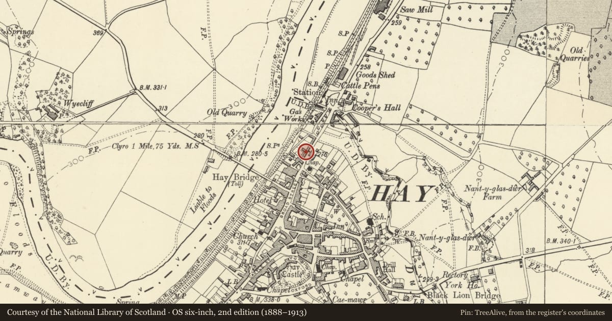
Slide toward Today to fade the historical sheet and see the modern map underneath.
David Rumsey Map Collection, Stanford LibrariesDavid Rumsey Map Collection, Stanford LibrariesDavid Rumsey Map Collection, Stanford LibrariesDavid Rumsey Map Collection, Stanford LibrariesDavid Rumsey Map Collection, Stanford Libraries
5 historical maps cover this location, the earliest the 1636 map "Cornubia : Devonia, Somersetus, Dorcestria, Wiltonia, Glocestria ..." (David Rumsey Map Collection, Stanford Libraries).
Historical maps covering this location
- 1636 · Cornubia : Devonia, Somersetus, Dorcestria, Wiltonia, Glocestria ... (David Rumsey Map Collection, Stanford Libraries)
- 1637 · Particular description of Wales. Cambria seu Wallia (David Rumsey Map Collection, Stanford Libraries)
- 1856 · 42. Brecon. (David Rumsey Map Collection, Stanford Libraries)
- 1898 · 197 Hay (Hills) (David Rumsey Map Collection, Stanford Libraries)
- 1901 · Sheet 14. (David Rumsey Map Collection, Stanford Libraries)
Cadw's description
Location
Set in the slope at the N end of the town detached to right.
History
Mid C19 (not shown on 1847 Tithe map); said to have been built as the Manse to the 1845 Ebenezer Chapel.
Exterior
Gothic 3-storey, 3-window rock faced rubble front with emphasized central bay and end full height pilasters. Slate roof, wide boarded eaves and rubble end chimney stacks, to right extended in stock brick.
Tudor stone labels over Gothic small pane windows - 1st floor has paired casements to outer bays, narrow and fixed to centre; similar window to ground floor right. 4-centred entrance with stone bracketed hood and boarded door flanked to left by broader and fixed glazed modern window in similar style with concrete lintel. Cement render right side and lean-to extension to modernised rear.
Interior
The unusually grand former rear entrance is retained within the kitchen extension (ca 1970); doorcase with panelled pilasters and reveals. Stone fireplaces, cellar with well.
Nearby in the register
- Ebenezer United Reformed ChurchReligious, Ritual and Funeraryunder 1 mi
- Poplar HouseDomesticunder 1 mi
- The Three Tuns P.H.Commercialunder 1 mi
- BrynhyfrydDomesticunder 1 mi
Other entries of the same register within about three miles of this one, by straight line.