Cof Cymru: National Historic Assets of Wales · Wales
Ty-isaf-rhos (aka Plas-yn-rhos)
Bryneglwys, Denbighshire, Wales
A Grade II listed building in Bryneglwys, Corwen, Denbighshire, designated on 19 July 1966.
The record
- Designation
- Listed building, Grade II
- Broad class
- Domestic
- Date of designation
- 19 July 1966
- Locality
- Bryneglwys
- Town
- Corwen
- Community
- Bryneglwys
- Unitary authority
- Denbighshire
- Country
- Wales
- Coordinates
- 53.02134, -3.24641
- Cadw reference
- 722
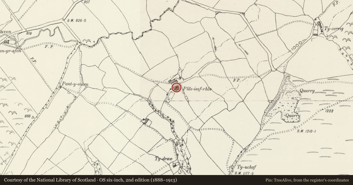
Slide toward Today to fade the historical sheet and see the modern map underneath.
David Rumsey Map Collection, Stanford LibrariesDavid Rumsey Map Collection, Stanford LibrariesDavid Rumsey Map Collection, Stanford LibrariesLlyfrgell Genedlaethol Cymru – The National Library of WalesDavid Rumsey Map Collection, Stanford Libraries
5 historical maps cover this location, the earliest the 1795 map "To Sir Watkin Williams-Wynn Bart ... the map of the six counties of North Wales is most humbly inscribed by his obedient humble servant" (Llyfrgell Genedlaethol Cymru – The National Library of Wales).
Historical maps covering this location
- 1795 · To Sir Watkin Williams-Wynn Bart ... the map of the six counties of North Wales is most… (Llyfrgell Genedlaethol Cymru – The National Library of Wales)
- 1883 · Watershed map England, Wales 3. (David Rumsey Map Collection, Stanford Libraries)
- 1898 · 121 Wrexham (Hills) (David Rumsey Map Collection, Stanford Libraries)
- 1898 · 121 Wrexham (Outline) (David Rumsey Map Collection, Stanford Libraries)
- 1901 · Sheet 9 and 10. (David Rumsey Map Collection, Stanford Libraries)
Cadw's description
Location
About 750 m south of the A5104, 1 km east of Bryneglwys village.
History
Plain Georgian small farmhouse with late C18 Gothick influece in its design. The gabled wing at the left is said to have carried the date 1784.
Exterior
A symmetrical two storey, two-window house with an additional gabled and slightly advancing bay at left. Rendered masonry painted white. Slate roof. Limestone end-chimneys to main part, brick end-chimney to additional bay. The main part has 16-pane sash-windows above and below, but the upper windows additional have Gothick pointed heads with interlaced glazing bars penetrating the eaves line and forming gablets. These are lead-clad above eaves level. Modern porch at front, with modern low wall and gate to small forecourt.
The additional bay at left has a 16-pane sash-window above and below. To the right of the lintel of the lower window is the mark of the covered date-stone.
At the rear the house has a catslide extension over service additions, but part of the upper strorey projects under a flat roof. Irregular fenestration to rear and sides, with many of the windows replaced in timber, steel or uPVC. Small rear porch at west.
Reason for designation
A good late-C18 farmhouse with Gothick influence in its design, which has retained its character notwithstanding enlargement.
Nearby in the register
- Ty Mawr Round BarrowsRound Barrowunder 1 mi
- Pant y Maen Round BarrowRound Barrowunder 1 mi
- Statue of a Barbarian to south of the walled garden at Plas-yn-IâlGardens, Parks and Urban Spacesunder 1 mi
- Statue of a Roman in walled garden at Plas-yn-IâlGardens, Parks and Urban Spacesunder 1 mi
Other entries of the same register within about three miles of this one, by straight line.