Cof Cymru: National Historic Assets of Wales · Wales
Herbert Hall
Crickhowell, Powys, Wales
A Grade II listed building in Crickhowell, Powys, designated on 25 September 1986.
The record
- Designation
- Listed building, Grade II
- Broad class
- Domestic
- Date of designation
- 25 September 1986
- Community
- Crickhowell
- Unitary authority
- Powys
- Country
- Wales
- Coordinates
- 51.85711, -3.13949
- Cadw reference
- 7166
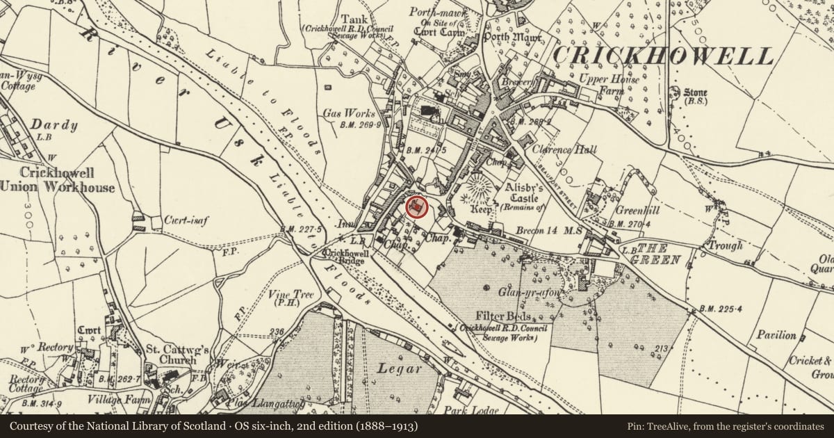
Slide toward Today to fade the historical sheet and see the modern map underneath.
David Rumsey Map Collection, Stanford LibrariesDavid Rumsey Map Collection, Stanford LibrariesDavid Rumsey Map Collection, Stanford LibrariesDavid Rumsey Map Collection, Stanford LibrariesDavid Rumsey Map Collection, Stanford Libraries
5 historical maps cover this location, the earliest the 1636 map "Cornubia : Devonia, Somersetus, Dorcestria, Wiltonia, Glocestria ..." (David Rumsey Map Collection, Stanford Libraries).
Historical maps covering this location
- 1636 · Cornubia : Devonia, Somersetus, Dorcestria, Wiltonia, Glocestria ... (David Rumsey Map Collection, Stanford Libraries)
- 1856 · 42. Brecon. (David Rumsey Map Collection, Stanford Libraries)
- 1898 · 232 Abergavenny (Hills) (David Rumsey Map Collection, Stanford Libraries)
- 1898 · 232 Abergavenny (Outline) (David Rumsey Map Collection, Stanford Libraries)
- 1901 · Sheet 14. (David Rumsey Map Collection, Stanford Libraries)
Cadw's description
Location
Situated at the top of Bridge Street near the junction with High Street and set back behind a walled courtyard; prominently sited above River Usk.
History
Mid C19 Regency-style rebuilding of an earlier C17 house of the Herbert family shown on map of 1760 and view of 1811; at one time incorporated the Beaufort Estate office.
Exterior
3-storey, 5-window scribed stucco front; slate roof with wide bracket eaves; end chimney stacks with grouped octagonal brick flues. Central cross gable with blind octofoil roundel. Recessed windows mostly replaced to 2nd floor, 12-pane sash windows to 1st and ground floors. Broad tripartite window to centre with moulded cornice and bracketed cill, 2-pane sashes flanking central blind arched opening and panelled base. Pitched roof porch below with ironwork ornamentation to uprights, spandrels and pediments. Half-glazed door with fanlight; lozenge leaded half-glazed door to right.
Interior
Interior retains ornate Jacobean open well staircase reused from previous house with four-centred arched to right; plaster ceilings with cornices to hall and dining room.
Reason for designation
Group value.
Nearby in the register
- 3 Bridge StreetDomesticunder 1 mi
- 5 & 6 Bridge StreetDomesticunder 1 mi
- 8 Bridge StreetDomesticunder 1 mi
- 39 Bridge StreetDomesticunder 1 mi
Other entries of the same register within about three miles of this one, by straight line.