Cof Cymru: National Historic Assets of Wales · Wales
7 Wheat Street
Brecon, Powys, Wales
A Grade II listed building in Brecon, Powys, designated on 31 May 1961.
The record
- Designation
- Listed building, Grade II
- Broad class
- Domestic
- Date of designation
- 31 May 1961
- Town
- Brecon
- Community
- Brecon
- Unitary authority
- Powys
- Country
- Wales
- Coordinates
- 51.94732, -3.39196
- Cadw reference
- 7145
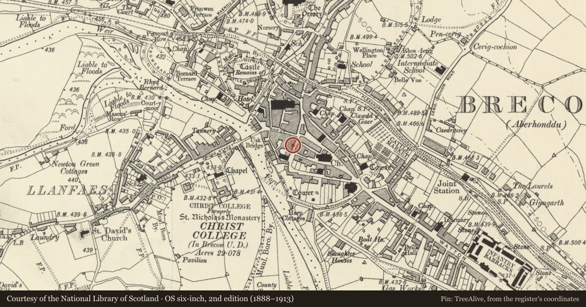
Slide toward Today to fade the historical sheet and see the modern map underneath.
David Rumsey Map Collection, Stanford LibrariesDavid Rumsey Map Collection, Stanford LibrariesDavid Rumsey Map Collection, Stanford LibrariesDavid Rumsey Map Collection, Stanford LibrariesDavid Rumsey Map Collection, Stanford Libraries
5 historical maps cover this location, the earliest the 1608 map "(13) Cambriae Typus." (David Rumsey Map Collection, Stanford Libraries).
Historical maps covering this location
- 1608 · (13) Cambriae Typus. (David Rumsey Map Collection, Stanford Libraries)
- 1636 · Cornubia : Devonia, Somersetus, Dorcestria, Wiltonia, Glocestria ... (David Rumsey Map Collection, Stanford Libraries)
- 1856 · 42. Brecon. (David Rumsey Map Collection, Stanford Libraries)
- 1898 · 213 Brecon (Hills) (David Rumsey Map Collection, Stanford Libraries)
- 1901 · Sheet 14. (David Rumsey Map Collection, Stanford Libraries)
Cadw's description
Location
Attached to S of Cinema.
History
Building with C19 features but probably with basically C17 structure.
Exterior
Former house, now office with accommodation above. Front to Wheat Street of 3 storeys, 4 windows; roughcast, slate roof. Small-pane sash windows on first and second floors. First floor windows squarish with 6 panes. On first floor, 12-pane sashes. On ground floor, central pedimented doorcase with pilasters; semi-circular fanlight with interlacing tracery; six-panelled door; cornice to each side of doorway (from former shopfront?). To each side, a recessed modern display window of 3 arched lights. Further doorway to R.
Interior
Vestibule with panelled door and semi-circular headed arch. Good C18 wooden stair to rear. SW first floor room with ceiling beam and cornice; fireplace with lugged surround. Ground floor room to L has stone overmantel with pierced quatrefoils of circa 1600 or earlier; beam and cornice; archway to rear with classical detailing. Fielded panelled doors. Ground floor room to R also with period fireplace. Cellar with rough beams.
Reason for designation
Building with well-preserved overall external early C19 character, and rare surviving C17 internal features. Group Value with adjacent listed buildings.
Nearby in the register
- 8 Wheat StreetCommercialunder 1 mi
- 9 Wheat StreetNo class recordedunder 1 mi
- 3 Wheat StreetNo class recordedunder 1 mi
- 2 Wheat StreetDomesticunder 1 mi
Other entries of the same register within about three miles of this one, by straight line.