Cof Cymru: National Historic Assets of Wales · Wales
Block 12 at Barracks
Brecon, Powys, Wales
A Grade II listed building in Brecon, Powys, designated on 16 December 1976.
The record
- Designation
- Listed building, Grade II
- Broad class
- Defence
- Date of designation
- 16 December 1976
- Town
- Brecon
- Community
- Brecon
- Unitary authority
- Powys
- Country
- Wales
- Coordinates
- 51.94466, -3.38336
- Cadw reference
- 7093
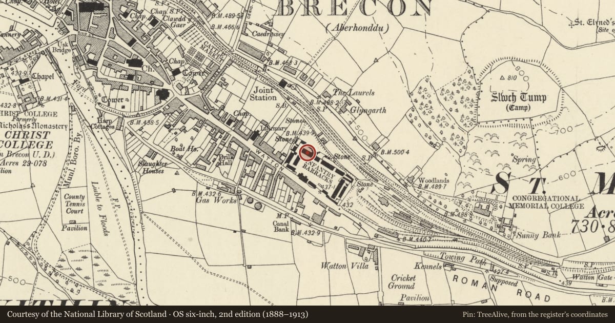
Slide toward Today to fade the historical sheet and see the modern map underneath.
David Rumsey Map Collection, Stanford LibrariesDavid Rumsey Map Collection, Stanford LibrariesDavid Rumsey Map Collection, Stanford LibrariesDavid Rumsey Map Collection, Stanford LibrariesDavid Rumsey Map Collection, Stanford Libraries
5 historical maps cover this location, the earliest the 1608 map "(13) Cambriae Typus." (David Rumsey Map Collection, Stanford Libraries).
Historical maps covering this location
- 1608 · (13) Cambriae Typus. (David Rumsey Map Collection, Stanford Libraries)
- 1636 · Cornubia : Devonia, Somersetus, Dorcestria, Wiltonia, Glocestria ... (David Rumsey Map Collection, Stanford Libraries)
- 1856 · 42. Brecon. (David Rumsey Map Collection, Stanford Libraries)
- 1898 · 213 Brecon (Hills) (David Rumsey Map Collection, Stanford Libraries)
- 1901 · Sheet 14. (David Rumsey Map Collection, Stanford Libraries)
Cadw's description
Location
At west end of N side of Parade Ground,
History
1842-4; designed by Colonel Ord, Government Royal Engineer.
Exterior
Three-storey 12-window elevation facing Parade Ground. Hipped slate hipped roof; ashlar chimney stacks; projecting eaves. Grey stone laid in regular courses with band at first floor sill level; ground floor rusticated; plinth. Doorways in 3rd and 8th bays from L. Twelve-pane horned sash windows.
Reason for designation
Part of fine C19 barracks complex. Group Value with other listed buildings on the site.
Nearby in the register
- Blocks 21 and 23 (HQ Block and Rear Block)Defenceunder 1 mi
- Museum at Brecon BarracksDefenceunder 1 mi
- Block 4 (RMP Office)Commercialunder 1 mi
- Blocks 14 and 15 (Sphinx House and Officers' Mess), including front garden wallsDefenceunder 1 mi
Other entries of the same register within about three miles of this one, by straight line.