Cof Cymru: National Historic Assets of Wales · Wales
Watergate Baptist Church
Brecon, Powys, Wales
A Grade II listed building in Brecon, Powys, designated on 16 December 1976.
The record
- Designation
- Listed building, Grade II
- Broad class
- Religious, Ritual and Funerary
- Date of designation
- 16 December 1976
- Town
- Brecon
- Community
- Brecon
- Unitary authority
- Powys
- Country
- Wales
- Coordinates
- 51.94830, -3.39338
- Cadw reference
- 7083
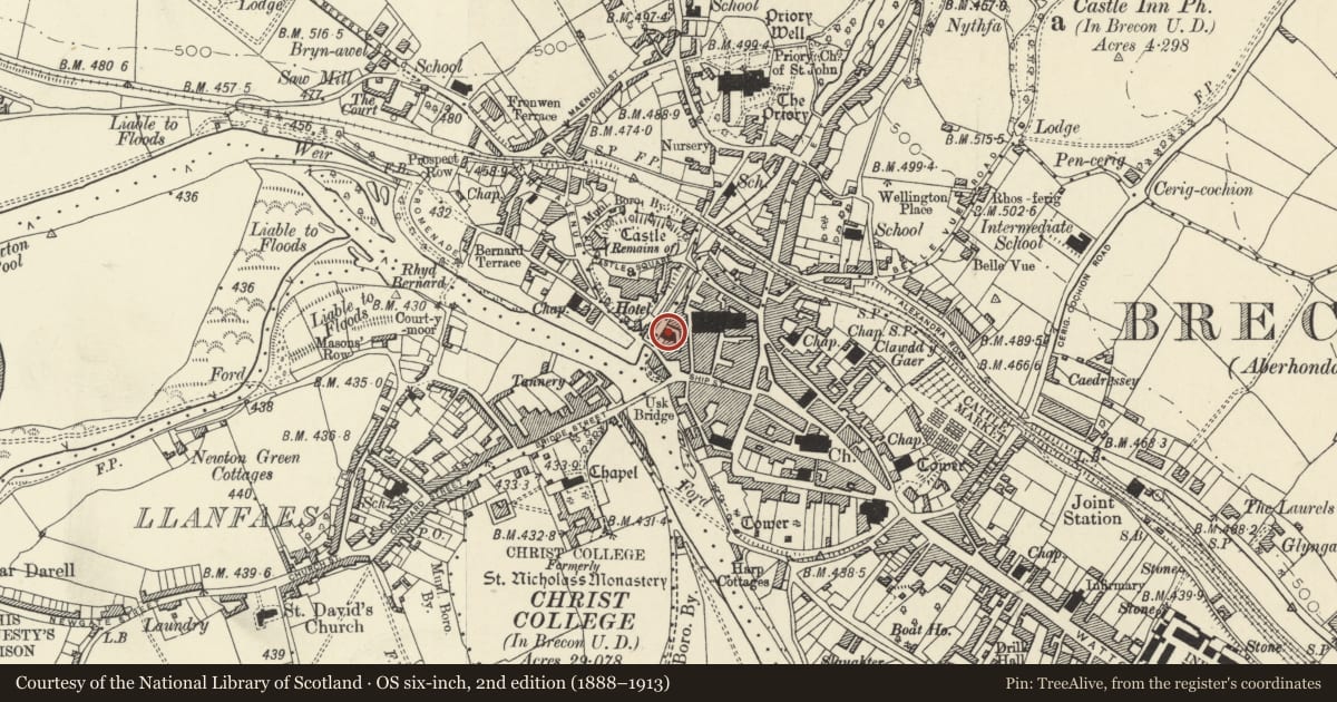
Slide toward Today to fade the historical sheet and see the modern map underneath.
David Rumsey Map Collection, Stanford LibrariesDavid Rumsey Map Collection, Stanford LibrariesDavid Rumsey Map Collection, Stanford LibrariesDavid Rumsey Map Collection, Stanford LibrariesDavid Rumsey Map Collection, Stanford Libraries
5 historical maps cover this location, the earliest the 1608 map "(13) Cambriae Typus." (David Rumsey Map Collection, Stanford Libraries).
Historical maps covering this location
- 1608 · (13) Cambriae Typus. (David Rumsey Map Collection, Stanford Libraries)
- 1636 · Cornubia : Devonia, Somersetus, Dorcestria, Wiltonia, Glocestria ... (David Rumsey Map Collection, Stanford Libraries)
- 1856 · 42. Brecon. (David Rumsey Map Collection, Stanford Libraries)
- 1898 · 213 Brecon (Hills) (David Rumsey Map Collection, Stanford Libraries)
- 1901 · Sheet 14. (David Rumsey Map Collection, Stanford Libraries)
Cadw's description
Location
Set back from Street next to Afon Honddu.
History
Built circa 1806; rebuilt circa 1880.
Exterior
Chapel with classical detailing; stucco. Pedimented front with roundel; urn finial. Quoins. Beneath the pediment, three semi-circular headed windows with margin lights in openings with keystones; shorter centre window with its head breaking into tympanum of pediment. Quoins. Central semi-circular headed stuccoed doorway with rusticated pilasters, archivolt with toothed course and keystone. North-west elevation to the Honddu of 2 storeys, 2 bays. To rear, 2 tall round-arched windows.
Reason for designation
Chapel with well-preserved character, in prominent position by Afon Honddu.
Nearby in the register
- 7 WatergateNo class recordedunder 1 mi
- Forecourt Walls, Piers, Gates and Railings to Watergate Baptist ChurchReligious, Ritual and Funeraryunder 1 mi
- 6 WatergateNo class recordedunder 1 mi
- Former Watergate MillIndustrialunder 1 mi
Other entries of the same register within about three miles of this one, by straight line.