Cof Cymru: National Historic Assets of Wales · Wales
Building to NW of St Mary's Church Tower
Brecon, Powys, Wales
A Grade II listed building in Brecon, Powys, designated on 16 December 1976.
The record
- Designation
- Listed building, Grade II
- Broad class
- Commercial
- Date of designation
- 16 December 1976
- Town
- Brecon
- Community
- Brecon
- Unitary authority
- Powys
- Country
- Wales
- Coordinates
- 51.94708, -3.39098
- Cadw reference
- 7036
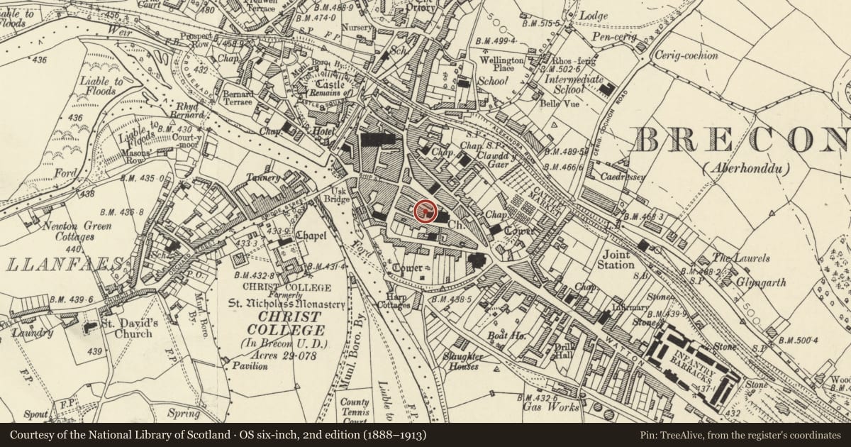
Slide toward Today to fade the historical sheet and see the modern map underneath.
David Rumsey Map Collection, Stanford LibrariesDavid Rumsey Map Collection, Stanford LibrariesDavid Rumsey Map Collection, Stanford LibrariesDavid Rumsey Map Collection, Stanford LibrariesDavid Rumsey Map Collection, Stanford Libraries
5 historical maps cover this location, the earliest the 1608 map "(13) Cambriae Typus." (David Rumsey Map Collection, Stanford Libraries).
Historical maps covering this location
- 1608 · (13) Cambriae Typus. (David Rumsey Map Collection, Stanford Libraries)
- 1636 · Cornubia : Devonia, Somersetus, Dorcestria, Wiltonia, Glocestria ... (David Rumsey Map Collection, Stanford Libraries)
- 1856 · 42. Brecon. (David Rumsey Map Collection, Stanford Libraries)
- 1898 · 213 Brecon (Hills) (David Rumsey Map Collection, Stanford Libraries)
- 1901 · Sheet 14. (David Rumsey Map Collection, Stanford Libraries)
Cadw's description
Location
Immediately to NW of tower of St Mary's Church with elevations to Steeple Lane and Church Lane.
History
Possibly C17 re-using some medieval masonry or windows. Appears in drawing of Steeple Lane dated 1800 in National Library of Wales.
Exterior
Two-storey former warehouse with stone walls and slate roof with hip to S. The SE wall which faces the tower of St Mary’s Church has, on first floor to R, a possible medieval window opening of large chamfered blocks of stone. To L, a window at eaves level and below, a wider opening with brick arched head. resting on a massive block of stone to each side. NE elevation with a gable; openings with cambered brick heads; three openings on first floor, ledged left door to right hand of centre with a window to either side. On ground floor, two doorways, one beneath loft door, and a window.
Reason for designation
A building with early origins, and Group Value with the adjacent St Mary's Church.
Nearby in the register
- 52 High Street InferiorCommercialunder 1 mi
- Fryer's Yard and North HouseDomesticunder 1 mi
- Pair of Telephone Call-boxes immediately to S of St Mary's Church TowerCommunicationsunder 1 mi
- 53 High Street InferiorCommercialunder 1 mi
Other entries of the same register within about three miles of this one, by straight line.