Cof Cymru: National Historic Assets of Wales · Wales
9 Ship Street
Brecon, Powys, Wales
A Grade II listed building in Brecon, Powys, designated on 16 January 1952.
The record
- Designation
- Listed building, Grade II
- Broad class
- Domestic
- Date of designation
- 16 January 1952
- Town
- Brecon
- Community
- Brecon
- Unitary authority
- Powys
- Country
- Wales
- Coordinates
- 51.94788, -3.39267
- Cadw reference
- 7023
Slide toward Today to fade the historical sheet and see the modern map underneath.
David Rumsey Map Collection, Stanford LibrariesDavid Rumsey Map Collection, Stanford LibrariesDavid Rumsey Map Collection, Stanford LibrariesDavid Rumsey Map Collection, Stanford LibrariesDavid Rumsey Map Collection, Stanford Libraries
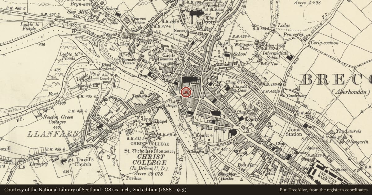
5 historical maps cover this location, the earliest the 1608 map "(13) Cambriae Typus." (David Rumsey Map Collection, Stanford Libraries).
Historical maps covering this location
- 1608 · (13) Cambriae Typus. (David Rumsey Map Collection, Stanford Libraries)
- 1636 · Cornubia : Devonia, Somersetus, Dorcestria, Wiltonia, Glocestria ... (David Rumsey Map Collection, Stanford Libraries)
- 1856 · 42. Brecon. (David Rumsey Map Collection, Stanford Libraries)
- 1898 · 213 Brecon (Hills) (David Rumsey Map Collection, Stanford Libraries)
- 1901 · Sheet 14. (David Rumsey Map Collection, Stanford Libraries)
Cadw's description
Location
Stepped down from No 8.
History
C16 to C17 timber-framed house with early C19 front added. Upper parts of building probably added in early C19.
Exterior
Cement rendered elevation to Ship Street of 3 storeys and attic, 2 windows. Slate roof with 2 hipped dormers with top-hung casements. First and second floors have 4-pane sash windows. C20 shop front on ground floor. Three-storey rear wing not accessible.
Interior
Upper floors not accessible at time of inspection.
Reason for designation
Building retaining both C17 and early C19 character. Group value with adjacent listed buildings in Ship Street.
Nearby in the register
- 10 Ship StreetDomesticunder 1 mi
- 8 Ship StreetCommercialunder 1 mi
- Boleyn House and Flats round Rear Courtyard and Stone Flagged PavementDomesticunder 1 mi
- 11 Ship StreetCommercialunder 1 mi
Other entries of the same register within about three miles of this one, by straight line.