Cof Cymru: National Historic Assets of Wales · Wales
Tredustan Hall
Talgarth, Powys, Wales
A Grade II listed building in Tredwstan, Talgarth, Powys, designated on 28 September 1961.
The record
- Designation
- Listed building, Grade II
- Broad class
- Domestic
- Date of designation
- 28 September 1961
- Locality
- Tredwstan
- Community
- Talgarth
- Unitary authority
- Powys
- Country
- Wales
- Coordinates
- 51.98333, -3.25476
- Cadw reference
- 6640
Slide toward Today to fade the historical sheet and see the modern map underneath.
David Rumsey Map Collection, Stanford LibrariesDavid Rumsey Map Collection, Stanford LibrariesDavid Rumsey Map Collection, Stanford LibrariesDavid Rumsey Map Collection, Stanford LibrariesDavid Rumsey Map Collection, Stanford Libraries
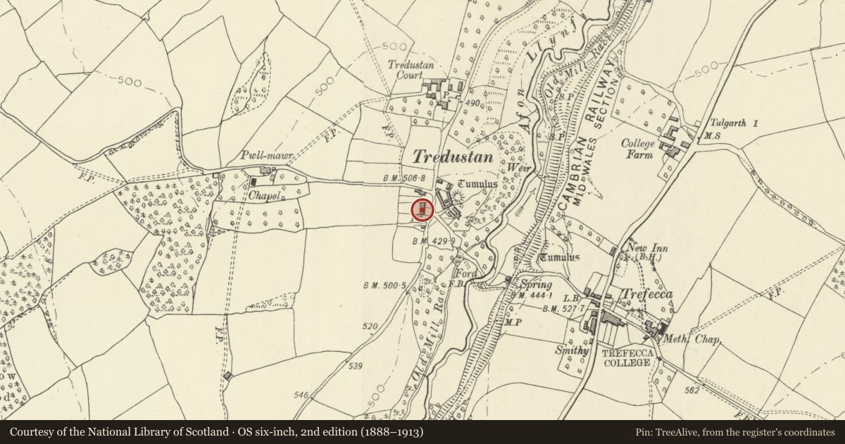
5 historical maps cover this location, the earliest the 1608 map "(13) Cambriae Typus." (David Rumsey Map Collection, Stanford Libraries).
Historical maps covering this location
- 1608 · (13) Cambriae Typus. (David Rumsey Map Collection, Stanford Libraries)
- 1636 · Cornubia : Devonia, Somersetus, Dorcestria, Wiltonia, Glocestria ... (David Rumsey Map Collection, Stanford Libraries)
- 1856 · 42. Brecon. (David Rumsey Map Collection, Stanford Libraries)
- 1896 · 214 Talgarth (Hills) (David Rumsey Map Collection, Stanford Libraries)
- 1901 · Sheet 14. (David Rumsey Map Collection, Stanford Libraries)
Cadw's description
Location
Located on rising ground overlooking the Afon Llynfi, on the minor road from Talgarth to Llanfihangel Tal-y-lyn.
Exterior
Gentry house of the late C17. Rubble stone with slate roof. Two storeys and attics, with full basement. Main elevation to E is of 7 window bays. Central boarded door and overlight raised over 6 steps and blank window above. One either side, 3 regularly spaced timber cross windows with straight drip course over timber lintels. Roof hipped and sprocketed, forming wide overhanging boxed eaves. Gable 2-flue stack at N end, and an added external stack to the rear of the S end. Small lobby over side door. Modern addition to N.
Interior
Entrance leads to square central hall with lateral fireplace on rear wall. Ceiling of 3 bays divided by cross beams. Door to stair at rear, and former door to cellars. Parlour at N end with end stack. Left bay contains kitchen and service room.
Reason for designation
Included as an important example illustrating the move from the vernacular tradition to the centrally-planned house-type in Wales at the end of the C17.
Nearby in the register
- Tredustan Castle MoundMotteunder 1 mi
- Tredustan CourtDomesticunder 1 mi
- Trefecca Castle MoundMotteunder 1 mi
- U-Shaped Ranges of Farm buildings enclosing the Farmyard at Tredustan CourtAgriculture and Subsistenceunder 1 mi
Other entries of the same register within about three miles of this one, by straight line.