Cof Cymru: National Historic Assets of Wales · Wales
Castle Lodge
Carew, Pembrokeshire, Wales
A Grade II listed building in Carew Lodge, Tenby, Carew, Pembrokeshire, designated on 14 February 1994.
The record
- Designation
- Listed building, Grade II
- Broad class
- Domestic
- Date of designation
- 14 February 1994
- Locality
- Carew Lodge
- Town
- Tenby
- Community
- Carew
- Unitary authority
- Pembrokeshire
- Country
- Wales
- Coordinates
- 51.69805, -4.82694
- Cadw reference
- 6603
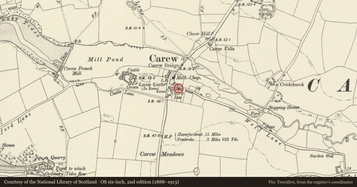
Slide toward Today to fade the historical sheet and see the modern map underneath.
David Rumsey Map Collection, Stanford LibrariesDavid Rumsey Map Collection, Stanford LibrariesDavid Rumsey Map Collection, Stanford LibrariesDavid Rumsey Map Collection, Stanford LibrariesDavid Rumsey Map Collection, Stanford Libraries
5 historical maps cover this location, the earliest the 1636 map "Cornubia : Devonia, Somersetus, Dorcestria, Wiltonia, Glocestria ..." (David Rumsey Map Collection, Stanford Libraries).
Historical maps covering this location
- 1636 · Cornubia : Devonia, Somersetus, Dorcestria, Wiltonia, Glocestria ... (David Rumsey Map Collection, Stanford Libraries)
- 1865 · England and Wales. England No. 6. (David Rumsey Map Collection, Stanford Libraries)
- 1891 · Sheet 10. Ordnance Survey of England and Wales. . (David Rumsey Map Collection, Stanford Libraries)
- 1898 · 228 Haverfordwest (Hills) (David Rumsey Map Collection, Stanford Libraries)
- 1901 · Sheet 13. (David Rumsey Map Collection, Stanford Libraries)
Cadw's description
Location
In a mid position in the row attached at the E end of the Carew Inn. There is a later rubble-stone wall at the front with gatepiers and an iron gate.
History
C18 origins; a cottage of three units. It has been suggested that the right-hand unit may originally have been a separate cottage. It appears to be shown on the 1750 estate map.
Exterior
Cottage with range of three windows, facing N to the village street. Rendered and painted white. Door at left of the centre unit. The roof of the right unit is slightly heightened. Artificial slates with tile ridges. Rendered chimneys. C18 12-pane windows above with hornless sashes and recessed frames below. Four-panel door and a gabled open porch.
Reason for designation
Listed as being part of a well-preserved worker's cottage and for group value with the other listed buildings of Picton Terrace.
Nearby in the register
- Old Stable CottageDomesticunder 1 mi
- 5 Picton TerraceDomesticunder 1 mi
- No 1 & 2Domesticunder 1 mi
- Telephone Call-boxCommunicationsunder 1 mi
Other entries of the same register within about three miles of this one, by straight line.